Mount Dimats
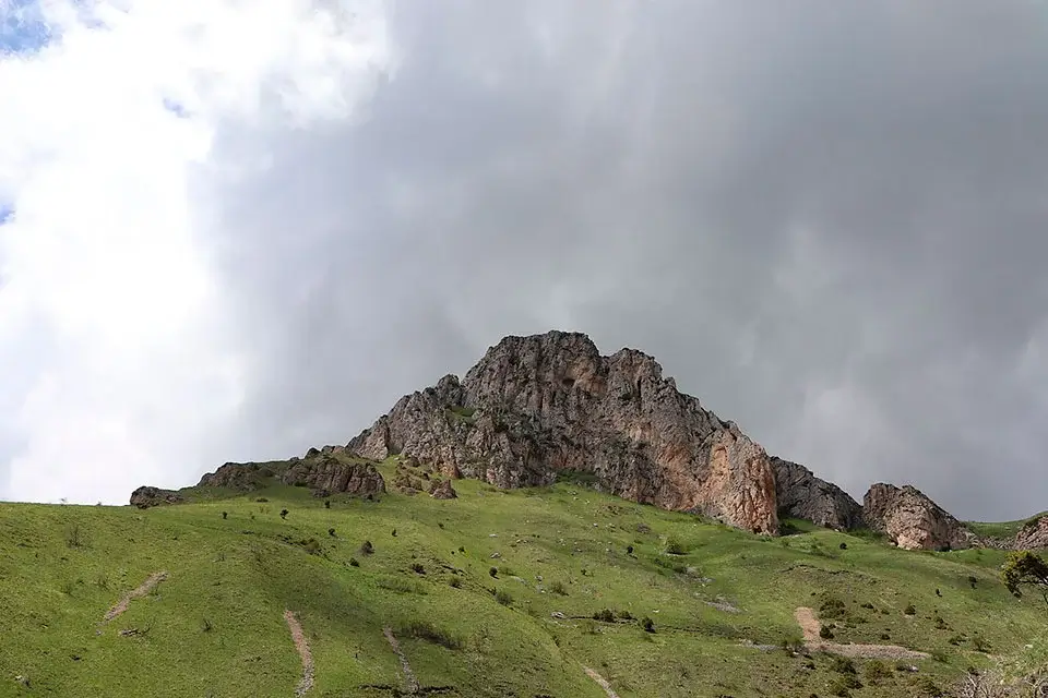
Mount Dimats is a 2,378-metre peak in the Ijevan Mountains of northern Armenia, rising above the forests of Dilijan National Park in Tavush Province. It is not the highest summit in the range — that title belongs to neighbouring Sartsapat at 2,532 m — but Dimats is by a wide margin the most popular hike in Tavush, drawing more day-trippers than any other peak in the region. The classic trail starts at the 13th-century Haghartsin Monastery, climbs through beech and hornbeam forest to a hidden waterfall detour, and finishes with a broad panoramic view across the rocky walls of the Ijevan range and the green valley of the Aghstev river.
Quick Facts
- Location: Tavush Province
- Also known as: Dimats Ler, Դիմաց լեռ
- From Yerevan: About 110 km to the Haghartsin trailhead; 1 hour 50 minutes to 2 hours one way
- Elevation: 2,378 m
- Time needed: 6–8 hours round trip on foot
- Best time to visit: Mid-May to mid-October
- GPS coordinates:
40.8220975, 44.9626083
About the mountain
Mount Dimats stands about 5 km north of the village of Teghut, in the southwestern part of the Ijevan Mountains — one of the low, densely forested ranges that give Tavush its reputation as the greenest province in Armenia. The peak sits entirely within Dilijan National Park, the country’s second-largest protected area, which covers roughly 24,000 hectares of beech, oak and hornbeam forest across the middle course of the Aghstev river.
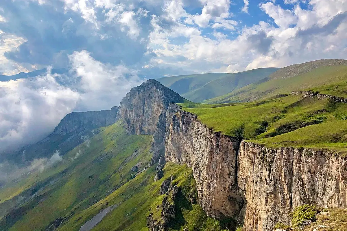
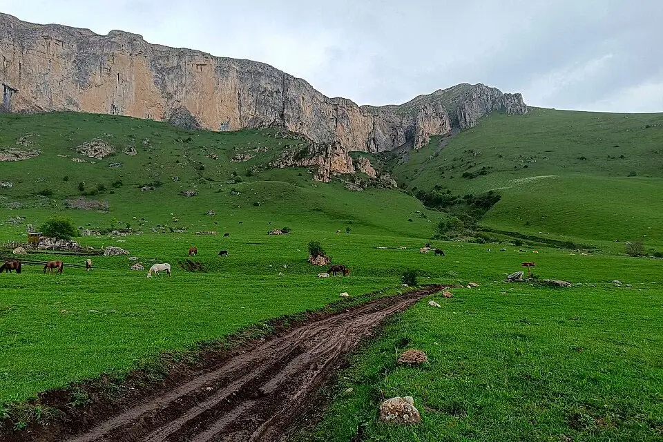
Geologically the Ijevan Mountains are a folded range rather than the volcanic massifs that dominate central and southern Armenia. There are no craters, no lava plateaux and no dragon stones on the summit ridge; the terrain is rounded and green, and the visual signature of the range is the line of white limestone cliffs that runs along the crest below the summit line. From the top of Dimats, these cliffs are the dominant feature of the panorama — a wall that curls south and east across the horizon and drops sharply into the forest below.
The name Dimats — Դիմաց in Armenian — literally means “opposite” or “facing“. Local tradition links the name to the mountain’s position facing the villages of the Aghstev valley, though no single etymological version is universally accepted.
Dimats is the second-highest peak in the Ijevan range. The highest is Sartsapat (2,532 m), immediately north-west and often visited on the same multi-day itinerary. Sartsapat gets a fraction of Dimats’s visitor numbers — it is remoter, harder to access, and does not have the same finish-line panorama — and for most hikers Dimats is the peak that defines the range.
The trail from Haghartsin Monastery
The classic Dimats hike begins at Haghartsin Monastery, a 10th–13th-century monastic complex tucked into a forested side valley about 18 km east of Dilijan. The monastery itself deserves an hour before or after the hike — three churches, a gavit, a refectory and a khachkar field, all restored in the 2010s with Emirati sponsorship — but the trailhead is a five-minute walk beyond the monastery along an asphalt road that quickly turns into forest track.
The route:
- Haghartsin Monastery → Hidden Waterfall junction. The path leaves the monastery and follows a narrow forest trail through beech and hornbeam. About 20 minutes in, you reach a marked waypoint with two options: left for the Hidden Waterfall (700 m detour each way), or right toward Dimats. The waterfall side-trip is worth the extra time — a small unmarked cascade in a mossy grotto, and rarely more than a handful of visitors even at midsummer.
- River crossing. After the waterfall junction, the trail crosses a small mountain stream. A wooden footbridge was built in the summer of 2024 — before that, hikers waded across in knee-deep water, which was a real obstacle in early season. The bridge has removed the crossing as a difficulty; the trail from here is straightforward.
- Forest track and farm areas. The path connects with jeep tracks used by shepherds moving flocks between summer meadows. This section is easy to misread — several parallel tracks head in the same direction — but the marked waypoints stay on the correct line. Shepherd dogs live near the farm huts; see the safety section below.
- Steep climb. After the farms, a sustained 400-metre climb on rough jeep track is the physically demanding section of the day. This is the part of the hike that earns the moderate-to-hard rating; the grade is steady and the surface loose.
- Vista point. A short right turn before the summit leads to a panoramic viewpoint below the top — this is the classic photograph of the hike, with the Ijevan range walls in one direction and the Aghstev valley in the other. Most hikers stop here for lunch.
- Summit. From the viewpoint, the summit is a further 30 metres of elevation and less than 10 minutes on foot. The top of Dimats is broad and flat, with no summit marker — no cairn, no cross, no plaque. The reward is the view, not the peak-bagger’s tag.
Trail at a glance:
- Distance: ~14 km round trip (main route); add 1.4 km for the Hidden Waterfall detour
- Elevation gain: ~1,000 m
- Moving time: 6–8 hours round trip
- Difficulty: Moderate; sustained climbing on rough surface
- Best season: Mid-May to mid-October
- Trail marking: Red-and-white blazes on rocks and trees; well-defined main line, occasional confusing forks in the farm section
Water on the trail. One reliable stream at the river crossing early on the route, and a spring near the farm huts. Both dry to a trickle by August. Carry two litres from Haghartsin and refill early rather than late.
Alternative trail from Hovk village
A second approach starts from the small village of Hovk, on the southern side of the range. The route from Hovk to the summit is longer than the Haghartsin approach, but the first 6 km can be driven by 4×4 vehicle, which cuts the hike significantly. The Hovk route also links directly to Sartsapat, so it is the standard line for hikers doing both peaks on the same trip.
Access to Hovk is by dirt road from the town of Ijevan. The village itself is small; there is no formal parking or trailhead sign, and the road onward is a rough farm track. This approach is best done with a local driver or a guided group.
When to go
- Mid-May to mid-October. The reliable window. Snow has cleared from the summit ridge, the wooden bridge is in place, and the trail is dry. June is the best month for wildflowers on the alpine meadows; September and early October for the beech-forest colours below the treeline and the sharpest air of the year for panoramic photography.
- August to early September. Peak visitor numbers. The weather can be stuffy at valley level, and 4×4 cars sometimes crowd the jeep-track section higher up. Weekdays are quieter than weekends.
- April and November. Transitional. The upper trail can still hold patches of snow in April and the first heavy snows sometimes arrive in November. Doable in a stable forecast but with real weather risk.
- Late November to mid-April. Out of season. The trail is snow-covered, the upper meadows and forest paths are impassable without full winter kit, and the wooden bridge over the stream is submerged or iced. Winter ascents are done via the jeep tracks from Hovk with proper mountaineering equipment.
Difficulty and who the hike suits
Dimats is moderate. The single-day elevation gain of about 1,000 metres over roughly 7 kilometres of ascent is at the top end of what a reasonably fit walker can manage as a full day out, but it is well below the two-day commitment of Mount Khustup or the altitude challenge of Mount Azhdahak. The rating factors:
- Distance and gain. ~14 km round trip, ~1,000 m elevation gain. Manageable for anyone in good hiking condition; a real day out for anyone new to mountain walking.
- Surface. Loose rock and gravel on the jeep-track sections; poles help on the descent.
- Navigation. The trail is marked, but the farm-track section has confusing forks. An offline GPX track is worth loading before you start.
- No altitude issue. The summit at 2,378 m is well below any real altitude-sickness threshold — this is a fitness hike, not a high-altitude hike.
Honest grade: a comfortable full day for anyone with prior hiking experience; a stretch but doable for a first serious mountain in Armenia. For a lighter introduction, Mount Gutanasar and Mount Hatis near Yerevan are better warm-ups; the natural step up in commitment is Mount Azhdahak on the Geghama range.
What to bring
- Sturdy hiking boots with proper ankle support and grippy soles
- Trekking poles — useful on the steep jeep-track descent
- A windproof shell and a warm mid-layer even in midsummer — the summit ridge catches wind from both sides
- 2 litres of water per person, with a refill top-up at the trail spring in early season
- High-calorie trail food; there is no shop or café on the route
- Offline map and GPX track loaded before you set out
- Head torch — the trail becomes shaded in the forest sections and an early start can begin before full daylight
- Sun protection: SPF 50 sunscreen, sunglasses, hat — UV is stronger on the exposed upper meadows than the forest suggests
- Basic first-aid kit including blister patches
- A stick or trekking pole useful for shepherd-dog encounters (see below)
Safety
- Shepherd dogs. The single most reported hazard on the Dimats trail — and, for that matter, on every Armenian trail that passes farms. Large mountain dogs guard the flocks; most are leashed or friendly, but some run free and can behave aggressively toward walkers. Standard advice: do not run, stop and let the dogs approach, keep a stick or trekking pole visible, and wait quietly until the shepherd calls them off. Attacks are rare; being ready is the right posture.
- Navigation in the farm section. Multiple jeep tracks run in parallel through the summer pastures. The marked line is correct but not always obvious; the waypoints are reliable but the intermediate visual cues can mislead. Follow the GPX track through this section rather than trusting terrain intuition.
- Weather on the summit ridge. Afternoon thunderstorms build fast over the range in June and July. The summit is exposed. Start early enough that you are off the top by early afternoon in unsettled weather.
- River crossing. The 2024 footbridge removes the crossing as a difficulty in normal water levels. In heavy spring flow or after storms, use judgement — the trail is not worth a swollen-river attempt.
- Cellular coverage. Reliable at Haghartsin Monastery and along the lower forest sections; patchy above 1,800 m; unreliable on the summit itself. Do not depend on a phone for navigation.
- Wildlife. Brown bears live in the forested lower slopes but avoid busy trails; wild boar are more common but also shy. Neither is a serious risk on the standard route. Making conversational noise on the wooded sections keeps animals aware of you.
How to get to Mount Dimats from Yerevan
Haghartsin Monastery, the standard trailhead, sits about 110 km north of Yerevan. The drive runs north on the M-4 highway through the Sevan tunnel, into Dilijan, and then east through the Dilijan National Park along the Aghstev river. Total drive time is 1 hour 50 minutes to 2 hours in normal conditions, though the last section from Dilijan to the monastery is a slow, winding forest road that can add 15 minutes if you are behind local traffic.
Most parties start the drive early — leaving Yerevan by 6 or 7 in the morning — to reach the trailhead with time for a full hike and a return in daylight. Overnighting in Dilijan the night before the climb shortens the drive to about 30 minutes and is the more comfortable option, particularly in summer when the Yerevan pre-dawn heat is unpleasant.
By private car with driver. The most straightforward option and the standard choice for most day-trippers. A private car with driver from Yerevan waits at the monastery while you hike, gets you back to Yerevan by evening, and handles the forest-road curves both ways.
As part of a private day tour. Dimats can be combined with a visit to Haghartsin Monastery, a stop at Dilijan Old Town on the way back, and — for a longer day — Lake Parz or Lake Sevan on the return route. See private tours from Yerevan for a custom itinerary.
Public transport. Marshrutkas from Yerevan’s Northern Bus Station reach Dilijan in about three hours. From Dilijan, there is no scheduled service to Haghartsin — a local taxi from the town centre costs about 3,000 AMD one way. Realistic for solo hikers on a budget; add half a day of buffer to the schedule.
Frequently asked questions
Mount Dimats is the peak that introduces most hikers to Tavush. The forest is greener than the volcanic uplands of central Armenia, the rocky wall of the Ijevan range is a photograph you will not see anywhere else in the country, and the 13th-century Haghartsin Monastery at the trailhead is worth the trip on its own. Plan a full day, start early, and leave time at the summit — the viewpoint is where Dimats does its real work.