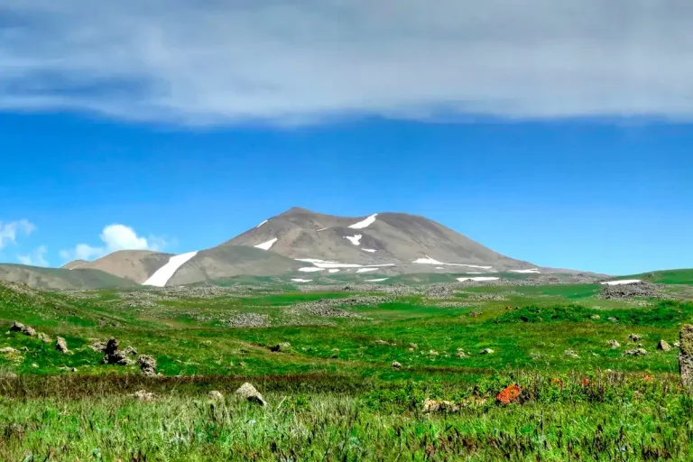
Mount Gutanasar
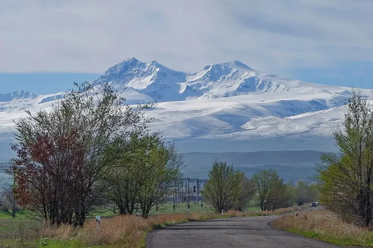
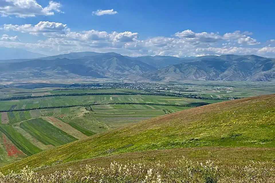
Mount Gutanasar is an extinct volcano in Armenia’s Kotayk region, an easy day hike from Yerevan and one of the most approachable peaks of the Geghama Range. The summit at 2,299 metres is reachable on a straightforward trail from the village of Fantan, and from the top a clear day opens views to Mount Ararat, Mount Aragats, Mount Hatis and Mount Ara at once.
Quick Facts
- Built / Founded: Pleistocene volcanic cone
- Location: Fantan, Kotayk Province
- Contained in: Geghama Range
- Also known as: Gutanasar, Gut'anasar, Գութանասար, Plough Mountain
- From Yerevan: About 45–70 minutes by car
- Elevation: 2,299 m
- Entrance fee: Free
- Time needed: 3–5 hours hiking; full day with the drive
- Best time to visit: May to October
- Status: Extinct volcano
The volcano: what makes Gutanasar special
Gutanasar is the western flank of the Geghama volcanic range, a chain of dormant volcanoes that stretches between the Yerevan basin and Lake Sevan. The mountain has a clean cone shape with a well-preserved crater and a long fissure running down its southern slope, marking the direction of the last lava flow. Geologically it is a Pleistocene volcano; its last eruption is estimated at around 200,000 years ago, and the cone is built mainly of Pleistocene lava, ash, perlite and pumice.
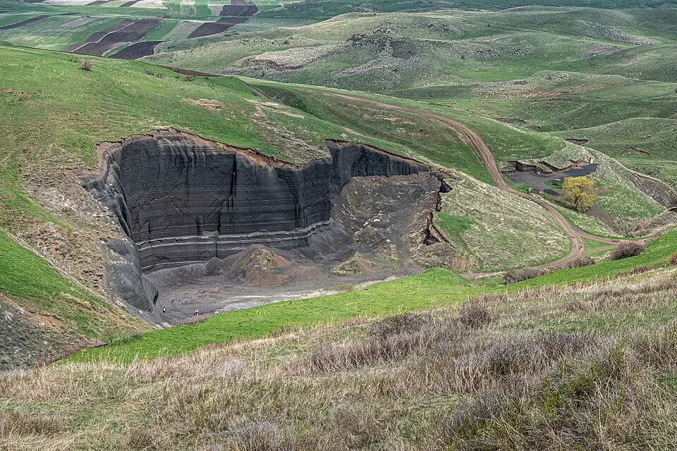
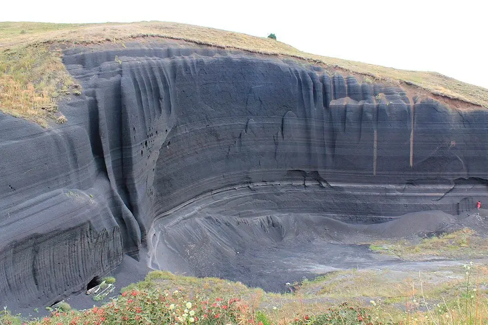
The name itself comes from the Armenian word gutan — “plough”. The folds and ridges along the mountain’s slopes are said to resemble the furrows a plough leaves in a field, and Gutanasar translates roughly as “Plough Mountain”. Lower down on the southern flank lies the so-called Black Wall, a section of exposed volcanic core showing the inner rock structure of the cone, and a small Black Sands zone where wind- and rain-eroded volcanic rock has weathered into striped layers that change colour with the light. Gutanasar was also one of the major obsidian sources used by prehistoric communities in central Armenia, and stone tools from the surrounding area appear regularly in archaeological excavations.
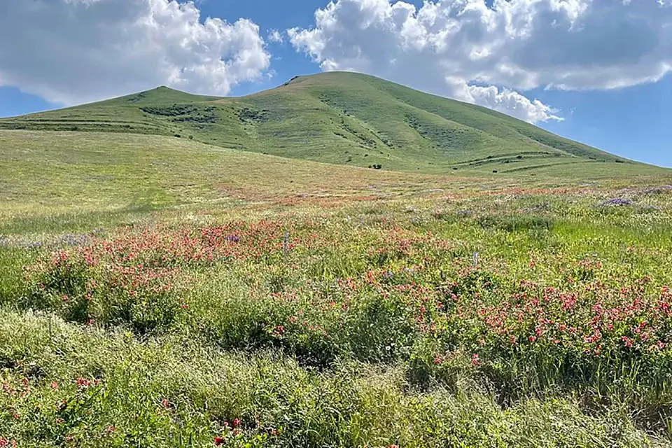
The hiking route from Fantan
The classic ascent of Gutanasar starts at the village of Fantan in Kotayk. From the edge of the village a rough track climbs gently up to the summer pastures at the foot of the cone, after which a steeper trail crosses grassy scree and lava rubble up to the saddle and on to the top.
A few key numbers for the standard route:
- Trailhead: Fantan village, Kotayk → unpaved track up to the pastures
- Distance (round trip): 8–12 km depending on the loop
- Elevation gain: roughly 400–600 m
- Moving time: 3–5 hours
- Drive from Yerevan to the trailhead: about 45–70 minutes
- Best months: May to October
The short version (8–9 km) goes up and back the same way. The longer version (11–12 km) descends along the southern ridge and exits on a parallel dirt road, which makes a nicer loop if your driver can pick you up at the lower exit rather than at the original trailhead.
When to go
May to October is the predictable window. The slopes are dry, visibility is stable and temperatures on the summit stay comfortable.
- April–early May. Approach roads can be muddy after spring rain — leave a buffer in your timing and use a vehicle with higher clearance.
- July–August. Hot and exposed; the top is treeless and there is no shade on the way up. Start at sunrise to beat the heat and the afternoon thunderstorms common on the Geghama range in late summer.
- September–October. Often the best window — cool days, clear visibility, golden steppe colours.
- November–April. The mountain holds snow from roughly December through March, and the road from Fantan becomes unreliable. Winter ascents are possible for experienced hikers with proper equipment; the lower north-facing slope is also occasionally used for backcountry skiing.
Difficulty and who the hike suits
Technically Gutanasar is an easy hike on open terrain. It works for beginners with a basic level of fitness and for travellers who want to try their first Armenian volcano without committing to anything serious. There is no scrambling and no exposure, but the slope is exposed to wind and the upper ridge can feel meaningfully harder on a windy day. Footwear with a grippy sole and a windproof layer matter more than technical gear.
What to bring
- Trekking shoes — trekking poles are useful but not required
- Windproof jacket plus a warm layer for the top; in summer a light rain shell
- 1.5–2 litres of water per person — there are no reliable water sources on the route
- An offline map or GPX track — the trail fades in places, especially in fog
- Power bank and a head torch
- Sun protection: sunglasses, sunscreen, hat
- For shoulder season and winter: gaiters or microspikes, warm gloves and a hat
Safety
- Weather changes fast. Fog and strong wind are common on the Geghama range. If a thunderstorm builds up, leave the ridge immediately.
- Navigation. On a clear day the trail reads well, but in cloud or low light it is easy to take the wrong line — keep a GPX track on your phone.
- Shepherd dogs. The pastures around Gutanasar are used in summer. Walk around herds at a distance, keep upwind, do not run, and stay calm if dogs approach.
- Snakes. The lower slopes are home to several reptile species. Stay on the trail and watch your step in tall grass during warm weather.
- Leave no trace. Take all your rubbish out, do not cut switchbacks and stay off fragile vegetation.
How to get to Mount Gutanasar from Yerevan
Drive from Yerevan towards Abovyan and continue to the village of Fantan. From the edge of Fantan an unpaved track leads south up to the pastures at the base of the cone. In dry weather a careful driver can usually reach the trailhead in a regular saloon car; after rain a higher-clearance vehicle is more comfortable, and after heavy rain 4×4 becomes useful. The drive from central Yerevan takes around 45 to 70 minutes.
The most comfortable way to do the hike as a day trip is with a car with driver — you can be dropped at the trailhead, picked up at the end of the longer loop if you want, and combine the hike with Garni Temple and Geghard Monastery on the way back to Yerevan.
What to see nearby
Gutanasar sits inside one of the densest sightseeing clusters in Armenia. Within a 30–45 minute drive you have:
- Bjni — a small village with a medieval fortress and natural springs, a good short stop on the way.
- Garni Temple and Geghard Monastery — the classic Kotayk pair, easy to combine in one day with a Gutanasar hike.
- Other Kotayk peaks — Mount Hatis (a slightly higher and longer cone-shaped hike) and Mount Ara / Aralеr (a bigger day out with more elevation gain).
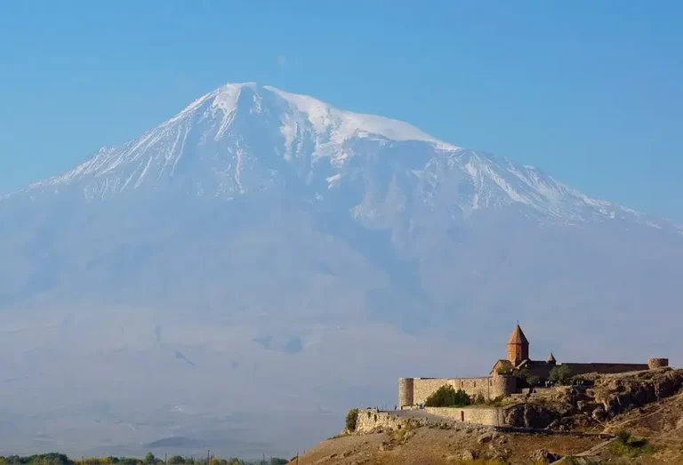
- For a step up in difficulty — Mount Azhdahak with its crater lake, or Mount Aragats, the highest mountain in Armenia.
Frequently asked questions
Mount Gutanasar is the easy first volcano in Armenia: a short drive from Yerevan, a short hike from Fantan, and a summit that rewards the climb with a clean panorama of every major peak in the western half of the country. It is the kind of hike you can do on a free morning between visits to Garni and Geghard, and a good way to test your legs before stepping up to Aragats or Azhdahak later in the trip.