Mount Aragats
Armenia’s highest mountain — an extinct four-peaked stratovolcano with summits up to 4,090 metres ringing a three-kilometre crater, climbed from Lake Kari on the southern slope.
Армения — небольшая страна с очень высокими вершинами. Около девяноста процентов её территории находится на высоте более 1000 метров, и почти из любой точки в центре страны в ясный день на горизонте видна как минимум одна крупная вершина. В этом разделе сайта собраны горы, которые наиболее достойны посещения — от простых однодневных походов в нескольких минутах езды от Еревана до серьёзных вулканических вершин и культового силуэта горы Арарат за границей.
Для каждой горы мы описываем маршрут восхождения, время года, сложность, время в пути из Еревана и начало маршрута — этого достаточно, чтобы вы могли выбрать вершину, соответствующую вашему времени и опыту. Карточки ниже открывают полную страницу с информацией о каждой горе.
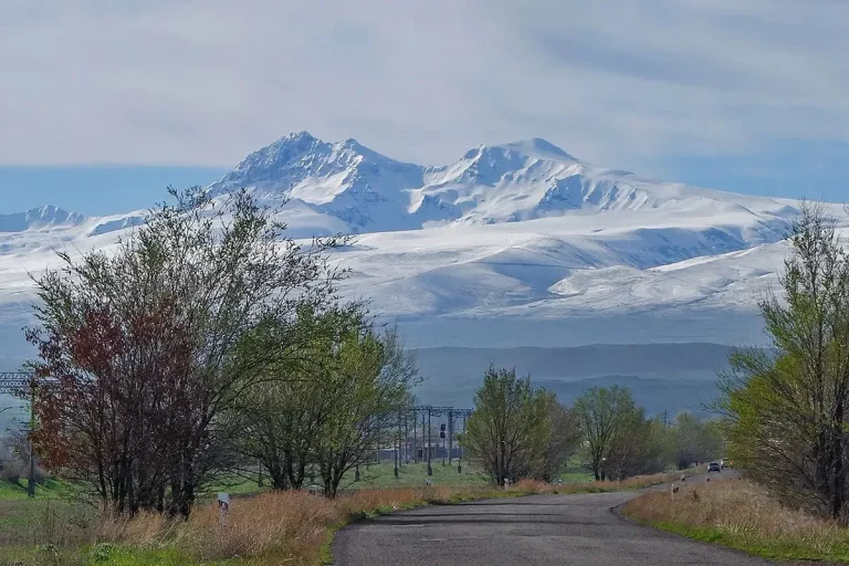
Armenia’s highest mountain — an extinct four-peaked stratovolcano with summits up to 4,090 metres ringing a three-kilometre crater, climbed from Lake Kari on the southern slope.
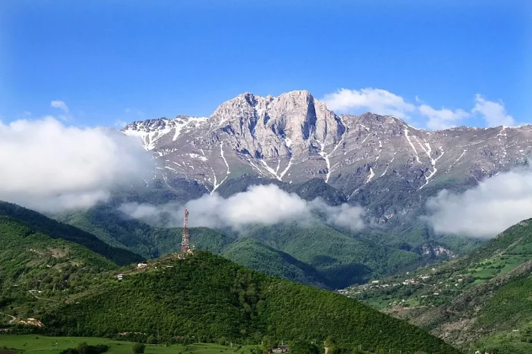
Sacred 3,206-metre peak in southern Armenia above Kapan — alpine meadows, pre-Christian pilgrimage springs and the longest, hardest day-hike summit in the Syunik mountains.
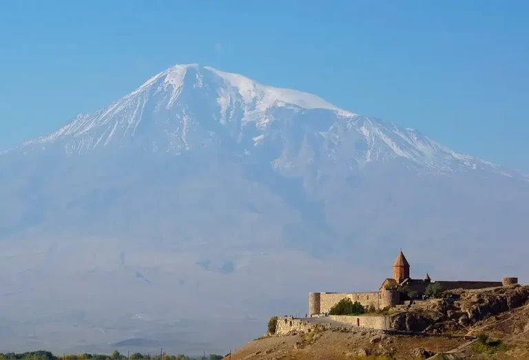
Twin volcanic peaks rising 5,137 metres above the plain — Armenia’s sacred mountain, visible from Yerevan and photographed best at sunrise from the monastery of Khor Virap.
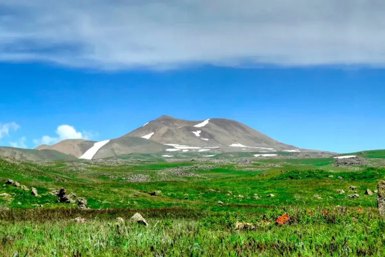
Highest peak of the Geghama range (3,597 m) with a perfectly round crater lake at the summit, surrounded by petroglyphs and ancient dragon stones — a serious day hike from Yerevan.

Easy 6-kilometre hike up Mount Artanish, a 2,461-metre peak on the Artanish Peninsula, with one of the best panoramic views of Lake Sevan in Armenia.

Extinct volcano 36 km north of Yerevan with a ring crater and the silhouette of a sleeping giant — the mythical mountain of King Ara the Beautiful.

Cone-shaped volcano of the Geghama range less than an hour from Yerevan — multiple trails from Kaputan, Zovashen and Argel, plus the Karasunakn springs and a hilltop cave.

Easy day hike to the 2,299-metre extinct volcano of Mount Gutanasar in Kotayk, an hour from Yerevan, with sweeping views of Aragats, Ararat, Ara and Hatis from the summit.
Armenia is a mountain country: the Aragats massif, the Geghama range and the high passes of Syunik. Mountain roads are often winding, seasonal and partly unpaved, so it is usually easier to travel with a driver who knows the route and the current road conditions.
For mountain destinations, the most practical options are a car with driver in Yerevan or the Mercedes V-Class with driver for families and small groups with luggage. High-altitude trailheads, viewpoints and mountain monasteries can also be visited with a guide — see our day tours from Yerevan.