Mount Azhdahak

Mount Azhdahak (Armenian: Աժդահակ) is the highest peak of the Geghama range and the most spectacular volcanic summit in central Armenia. A 3,597-metre extinct volcano in the middle of a high lava plateau, it carries a perfectly round crater lake on its summit, sits inside a field of prehistoric petroglyphs and vishapakar (dragon stones), and offers one of the longest panoramic views in the country — from Mount Ararat in the south to Lake Sevan in the north-east. It is also the first genuinely serious day hike in the cluster of mountains around Yerevan, and the climb that visitors with mountain experience tend to come specifically to do.
Quick Facts
- Location: Geghama Range, Gegharkunik Province
- Also known as: Azhdahak, Ajdahak, Azhdahak Volcano, Աժդահակ
- From Yerevan: Full-day 4×4 trip
- Elevation: 3,597 m
- Entrance fee: Free
- Time needed: Full-day trip from Yerevan; 5–7 hours on trail
- Best time to visit: July–September
- GPS coordinates:
40.225761, 44.947256
About the mountain
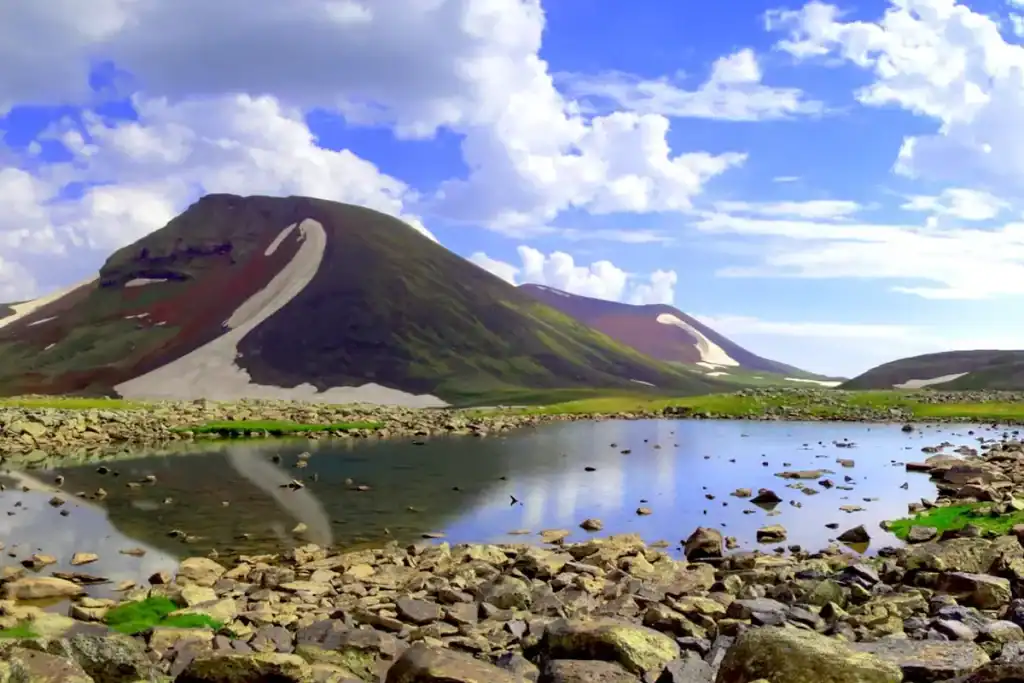
Azhdahak is an extinct stratovolcano in the central section of the Geghama range, the long volcanic chain that runs between the Yerevan basin and Lake Sevan. The crater on its summit is around 500 metres in circumference and 50 metres deep, and most of the year it holds a small circular lake fed by snowmelt — local Armenian tradition calls it Vishapa Lich or Vishapalich (“Dragon Lake”). The slopes around the cone are open, treeless and covered in basalt scree, which gives the upper plateau its characteristic “Martian” character. Snow lingers on the summit cone well into June in most years.
The name itself is layered. In Iranian mythology, Aži Dahāka is the great dragon defeated by the thunder god Thraetaona; aži means “snake” or “viper”. In Armenian folklore, Azhdahak doubles as the name of a Median king and of a vishap (a dragon-spirit), and the same word is the root of the vishapakar — the prehistoric “dragon stones” that surround the crater. Both threads come together on the mountain: the volcano, the lake, the carvings and the legend share one name.
The plateau around the mountain is one of the richest archaeological landscapes in Armenia. Petroglyphs dating back as far as the 12th millennium BC are scattered across the surrounding rocks, depicting goats, deer, hunters with bows, and stylised animals — Armenia has roughly 20,000 known petroglyphs, and the Geghama range is one of the five main concentrations. Carved menhir-like vishapakar, some over a metre tall, stand near the high lakes around the mountain and are commonly associated with ancient Armenian water cults.
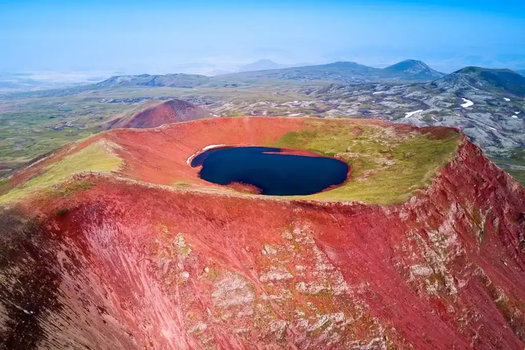
The crater lake at the summit
The crater on top of Azhdahak is the headline visual of the climb. Walk up the last switchback, look down off the rim — and instead of a peak you see a perfectly round bowl with a small lake at the bottom, blue or steel-grey depending on the light, the sky and the wind. The water comes from snowmelt and is clear enough that the floor of the crater is visible across most of its width. The colour of the lake changes through the day; many photographers come specifically for the late-afternoon light when the surface reads almost luminous.
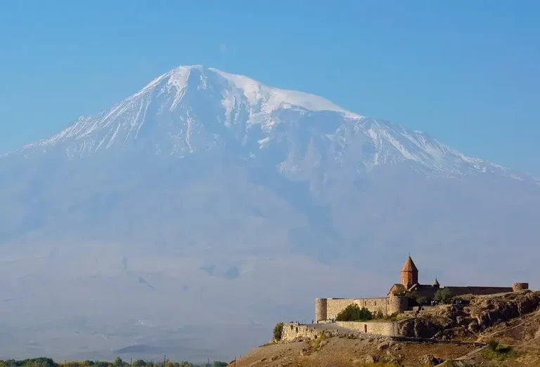
The crater rim makes a natural walking line. A full lap around it takes about thirty to forty minutes and gives a different angle on the lake from each side — and, on a clear day, lines up with the silhouettes of Mount Ararat, Mount Aragats, Mount Ara and Mount Hatis on every horizon.
Petroglyphs and dragon stones (vishapakar)
The Geghama plateau holds one of the densest collections of prehistoric rock art in the South Caucasus. Approach routes to Azhdahak pass groups of carved basalt panels with images of goats, deer, hunters, dogs and abstract figures — most experts date the earliest carvings to the 5th to 12th millennia BC. The largest concentrations are near Lake Vank and on the saddles between Azhdahak and its neighbour peaks.
Around the upper lakes you also find vishapakar — large carved stones, traditionally interpreted as a Bronze Age water cult, that stand near springs and lake outlets across the Armenian Highlands. The ones near Azhdahak are usually engraved with stylised fish, snakes and bull-hide motifs. Together with the crater lake and the volcanic plateau, they make Azhdahak the most concentrated archaeological-natural site of any mountain in Armenia.
The trail to the summit
There are several reasonable approaches, and the choice changes the day’s character significantly. Three trailheads are commonly used:
1. Sevaberd (classic, full-length route). The full-on day. From the village of Sevaberd, east of Yerevan, the trail climbs the Geghama plateau, passes Lake Akna (a separate crater lake at 3,032 m), and continues up to Azhdahak. Distances depend on the exact line:
- Sevaberd → Lake Akna: about 13 km, ~1,000 m of elevation gain
- Lake Akna → Azhdahak summit: about 15 km, ~750 m of further elevation gain
- Sevaberd → Azhdahak (one direction, walking the whole way): 12–18 km depending on loop choice
- Round-trip moving time: 5–8 hours of walking on top of the drive
Most parties do this with one or two nights of wild camping; it is also possible as a long single-day push for fit hikers who start before dawn.
2. Geghard or Goght (shortened route with 4×4 transfer). The fastest way to the summit. A 4×4 vehicle takes you from Geghard or Goght up to roughly 3,000 metres, and from there it is about a 14 km round trip with around 550–750 m of further elevation gain on foot. This is the format used by most one-day organised tours. It is still a real high-altitude climb — just without the 13 km approach from the village.
3. Multi-day traverse on the Transcaucasian Trail. Sevaberd → Lake Akna → Azhdahak → Geghard is part of the Transcaucasian Trail and is regularly done as a 2–3 day wild-camping route. This is the way to see the full archaeological landscape, sleep under exceptionally dark night skies, and link the climb with the petroglyphs and the dragon stones at an unhurried pace.
The summit cone itself is basalt scree with patches of snow lingering into July most years. Trekking poles help significantly on the loose ground; a windproof shell is needed at the top in every season. Mobile coverage is poor across the entire plateau and absent above 3,200 m on most days — an offline map and a GPX track are not optional.
When to go
- July to September. The reliable hiking window. Snow has cleared from the summit cone and the access roads, daytime temperatures on the plateau are comfortable (5–15 °C), thunderstorm risk is moderate and predictable. Late July to mid-September is the sweet spot for the crater lake, when the water level is highest and the surrounding meadows still hold colour.
- Early June. Snow patches and snowmelt streams across the plateau; access roads can still be impassable to standard vehicles. Climbs are possible but require winter-mountain experience and the right gear.
- October. Cold, often the best visibility of the year, but afternoon storms can come with very little warning and snow can return any week from mid-month onwards. End-of-season risk goes up sharply.
- November to May. Full winter on the plateau. The summit is not realistically reachable except as a serious ski-touring or winter-mountaineering objective, with avalanche risk on several of the standard lines.
Start at dawn in any season. Afternoon thunderstorms over the Geghama range are common from mid-July onwards, and the mountain has no shelter anywhere above the plateau edge.
Difficulty and who the hike suits
Azhdahak is the first genuinely serious mountain in the cluster around Yerevan. It is not a beginner outing. The factors that change the difficulty profile sharply versus the easier day mountains nearby:
- Altitude. The summit sits at almost 3,600 metres. People who have not been at altitude before should expect the standard symptoms — slower pace, mild headache, breathlessness — and plan accordingly. Hiking up to Lake Akna or another high lake the day before, then attempting the summit, helps considerably.
- Distance. Even the short route from the 4×4 drop-off is a 14 km round-trip; the full route from Sevaberd runs 28–30 km over two days.
- Weather exposure. The Geghama plateau is treeless, shadeless and consistently windy. Storms come fast and the descent line is exposed everywhere.
- Navigation. Trails are not signposted and braid across the plateau; in fog the direction is genuinely difficult to hold.
Honest grade: moderate to hard day hike on the 4×4 short route, hard day hike or comfortable two-day walk on the full Sevaberd route. For first-time Armenian hikers, Mount Hatis, Mount Gutanasar or Mount Artanish are better warm-ups; Azhdahak rewards hikers who already know how their body handles a long day at altitude.
What to bring
- Proper hiking boots with stiff ankle support; the basalt scree on the summit cone is hard on softer footwear
- Trekking poles — useful on the upper scree and on the descent
- A real windproof shell and warm mid-layer; the summit is colder than the plateau and the wind is constant
- A second warm layer, gloves and a beanie even in July
- 2–3 litres of water per person — sources on the plateau are not always reliable in late summer
- High-calorie trail food (the day is long)
- Offline map and GPX track, head torch, power bank
- Sun protection: high-SPF sunscreen, Cat 3 sunglasses, a wide-brimmed hat — the UV at 3,500 m on a clear day is intense
- A whistle and a light emergency blanket
- In June or October: micro-spikes or boot chains, and waterproof gaiters
Safety
- Altitude. Most parties spend at least one night above 3,000 m before pushing for the summit; the standard 4×4-and-summit day from 3,000 m is fast enough that altitude is usually manageable, but it is still genuine high altitude.
- Lightning. Afternoon storms are common from mid-July. The summit cone is exposed and there is no shelter on the plateau. If clouds are building, turn back without going to the rim.
- Wind chill. Temperatures on the rim can fall below freezing on a windy summer afternoon, even when the trailhead is 25 °C.
- Navigation in fog. The plateau braids into multiple paths and the right line into the upper crater is genuinely hard to find in poor visibility. If the fog rolls in, stop and wait it out rather than guessing.
- Shepherd dogs. The Geghama plateau is grazed in summer by Armenian and Yazidi shepherds (the Yazidis are Armenia’s largest ethnic minority and have herded these high pastures for over a century). Their dogs are protective. Walk around flocks at a distance, keep upwind, do not run, and let the dogs check you out calmly.
- Cellular coverage. Reliable below 2,500 m, patchy on the plateau, almost absent above 3,200 m. Carry a paper plan that does not depend on a phone.
How to get to Mount Azhdahak from Yerevan
The Sevaberd trailhead is roughly 40 km east of Yerevan — paved road to the village, then dirt road onto the Geghama plateau. From central Yerevan to Sevaberd is around 1 hour 30 minutes; from Sevaberd to a useful start point on the plateau is another 30–60 minutes of slow driving. In dry weather a high-clearance saloon car can manage the lower sections; above 2,800 m, a 4×4 is recommended in every season.
The Geghard / Goght alternative — used by most one-day organised climbs — drives a 4×4 up to roughly 3,000 m from the village of Geghard, just past the famous Geghard Monastery. From the 4×4 drop-off the summit hike is about 14 km round-trip.
Public transport does not reach either trailhead. The simplest way to do this climb as a day trip is with a 4×4 car with driver that knows the plateau roads, or as part of an organised day tour from Yerevan — Azhdahak is one of the climbs where a guide adds real value, both for the route-finding above the plateau edge and for reading the weather.
What to see nearby
The Azhdahak climb sits inside one of the richest concentrations of natural and archaeological attractions in central Armenia:
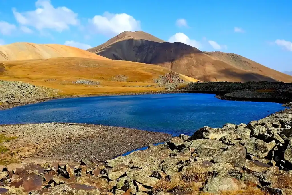
- Lake Akna — separate crater lake at 3,032 m, the classic camp point on the Sevaberd route.
- Lake Vank and Lake Vishapalich — smaller crater lakes near the summit, both surrounded by vishapakar dragon stones.
- Lake Badi — high-altitude lake on the southern descent toward Geghard.
- Geghama petroglyphs — multiple groups along all standard approaches; the ones near Lake Vank are the best preserved.
- Geghard Monastery and Garni Temple — the classic Kotayk pair, the natural cultural pairing on the way back from a Geghard-side climb.
- Neighbouring mountains: Mount Hatis, Mount Gutanasar, Mount Ara (when published) and Mount Artanish (when published) for shorter days that suit different fitness levels.
Frequently asked questions
Azhdahak is the most ambitious one of the day mountains you can climb from Yerevan, and the only one where every reason to make the effort — the crater lake, the petroglyphs, the dragon stones, the four-summit panorama, the volcanic plateau — is genuinely unmatched anywhere else in the country. It rewards travellers who treat it seriously and gives them a day they remember for the rest of the trip.