Kechut Reservoir

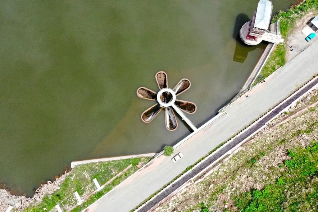
Kechut Reservoir sits on the Arpa River a few kilometres south of the spa town of Jermuk, in Armenia’s Vayots Dzor Province. It’s a working piece of Soviet-era hydro-engineering rather than a recreation lake — but the bell-mouth spillway in the middle of it, a six-petal star carved from stone, has become one of the most photographed sights on the road to southern Armenia. Travellers usually stop here for twenty minutes on the way to or from Jermuk to look at the “Daisy”, and that’s exactly the right amount of time.
Quick Facts
- Location: Arpa River valley, south of Jermuk, Vayots Dzor Province
- Also known as: Kechut Reservoir, Kechutskoye Reservoir, Kechut Daisy Spillway, Կեչուտի ջրամբար
- From Yerevan: 170 km / about 2 hr 50 min
- Depth: up to 36 m
- Elevation: 1,950 m
- Entrance fee: Free
- Time needed: 20–30 minutes on site; pairs with Jermuk day trip
- Best time to visit: Late April–June (high water, active spillway)
- Status: Working reservoir; Arpa-Sevan water system
- GPS coordinates:
39.7986, 45.6572
The Star-Shaped Spillway — Why People Stop Here
The defining feature of Kechut is its bell-mouth spillway — a vertical drain set in the reservoir that activates when the water level rises above a set point. Excess water pours over the rim of the structure and disappears into an underground conduit. What makes this one unusual is the shape of the rim: six stone “petals” arranged like a flower, which is why locals call it the “Daisy” (Margaritka in Russian, Margaritka in everyday Armenian use). Online it’s better known as the star-shaped spillway of Armenia, and bell-mouth spillways are normally round — Kechut’s six-petal geometry is the unusual case.
A footbridge with a viewing platform passes directly over the spillway. From it you can watch water spill over the petals and vortex down into the mountain — most dramatic in late spring when meltwater pushes the reservoir to its high mark and the bell mouth is running at full flow. The rest of the year the rim is dry and the petals sit above the waterline like a piece of sculpture.
This is the single photo most visitors come for.
The Arpa-Sevan Tunnel — Why the Reservoir Exists
Kechut wasn’t built for tourists; it was built to save Lake Sevan. By the 1960s, intensive Soviet-era water withdrawal had dropped Sevan’s level by around 20 metres, and the lake was on its way to ecological collapse. The engineering response was ambitious: drive an underground tunnel through the Vardenis Range to divert the Arpa River into Sevan, with Kechut as the intake basin at the start of the system.
The Arpa-Sevan tunnel is roughly 48 km long and was completed in 1981 after almost two decades of construction. For scale: the Channel Tunnel between England and France is only about three kilometres longer. A second tunnel — Vorotan-Arpa, 21.6 km — was added in 2003 to feed Kechut with water from Spandaryan Reservoir further south, extending the system again. Together the two tunnels are still the backbone of the project that keeps Sevan’s water level stable.
A more melancholy footnote: when the reservoir was filled, an old and medieval cemetery with khachkars (cross-stones) on the valley floor was submerged. That history is invisible from the road today but worth knowing.
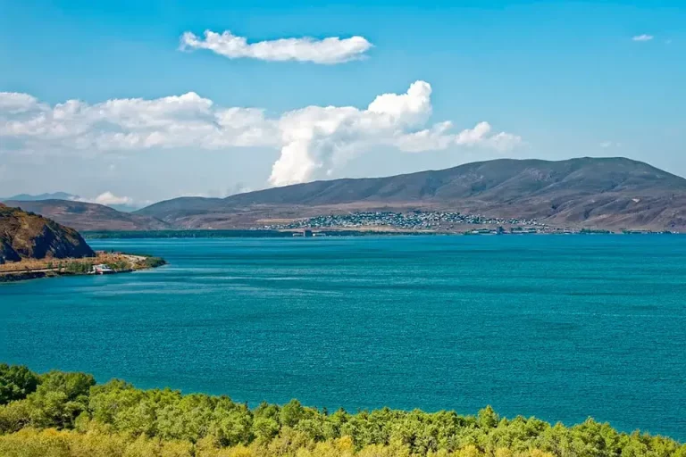
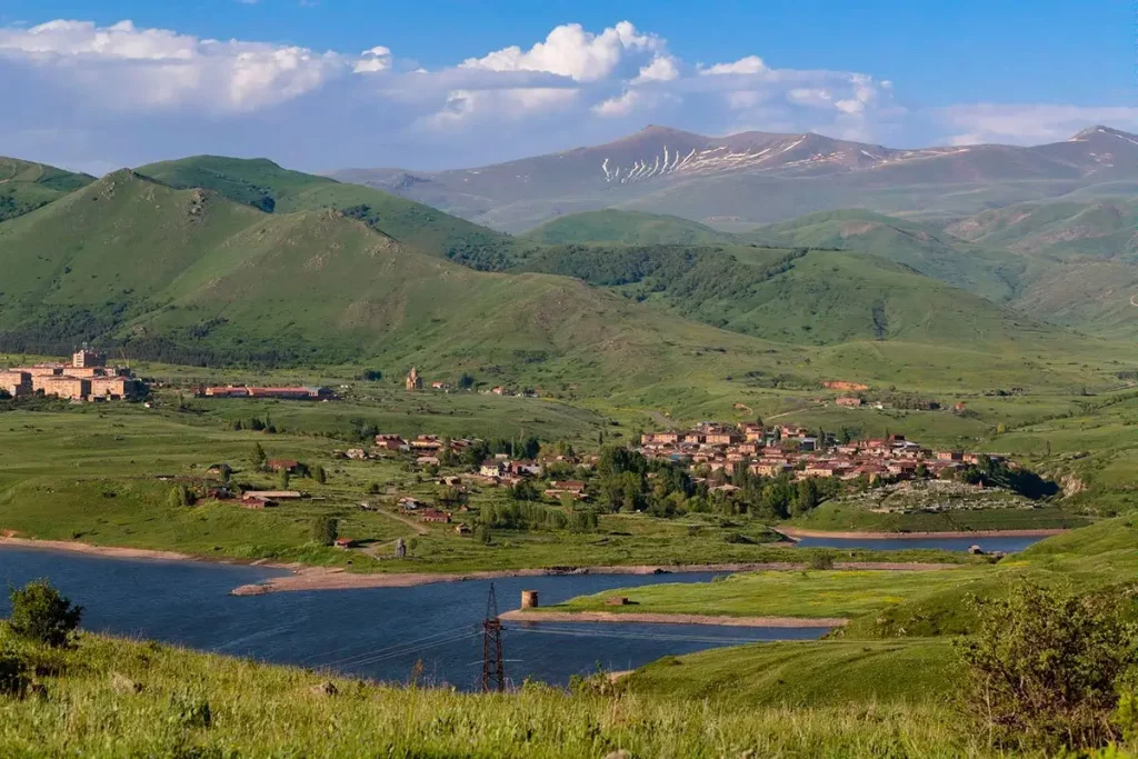
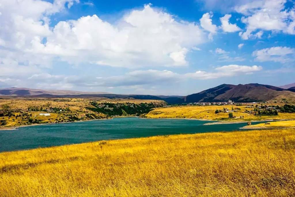
Where Kechut Sits
The reservoir lies on the Arpa River about 2.6 km south of Jermuk town, at an elevation of 1,950 m. It’s around 3.2 km long, 0.8 km wide, with depth reaching about 36 m in the centre. Mountains rise on both sides — the Vardenis Range to the east, the southern walls of the Jermuk plateau to the west. The shoreline is rough and largely undeveloped: no beach, no walking trail, no infrastructure, just the spillway, the bridge, and the view from the road.
The water is part of Sevan’s drinking-water supply system, so swimming and shoreline activities aren’t permitted.
How to Get to Kechut Reservoir
From Yerevan the reservoir is 170 km via the M-2 highway south, with a left turn off the main road toward Jermuk. Driving time is about 2 hours 50 minutes without long stops. The road is fully paved and in good shape; the reservoir comes into view directly from the highway before you reach Jermuk itself.
The straightforward setup is a car with driver from Yerevan, which lets you fold Kechut into the standard southern circuit — Khor Virap, Areni, Noravank, Jermuk, return. For groups and families the same loop fits in a minivan with driver. The most efficient way to see Kechut is as part of a private day tour from Yerevan toward Vayots Dzor — most travellers don’t drive 170 km one way just to see a spillway.
Public transport: marshrutkas run from Yerevan to Jermuk; from Jermuk the reservoir is a short taxi ride or about an hour on foot. There’s no direct service to Kechut itself.
When to Visit
Late April to mid-June is the most dramatic window — meltwater raises the reservoir to its high level and the spillway runs at full force.
July to September brings warm weather, sharp light and easy photography conditions, though the bell mouth itself may not be flowing.
October turns the surrounding hills gold, with the reservoir often still high enough for an active spillway after autumn rain.
Winter sees the reservoir partly freeze; the road from Yerevan is normally cleared but high passes can be slow after snowfall. The bell mouth in ice is a striking sight in its own right.
At 1,950 m the air is noticeably cooler than in Yerevan even in summer — a windbreaker is sensible year-round.
What to See Nearby
- Jermuk Waterfall — the “Mermaid’s Hair”, one of the tallest waterfalls in Armenia, about 4 km from the reservoir in the town’s park.
- Jermuk town itself — a Soviet-era spa town built around hot mineral springs, with a drinking gallery, cable car and the bottling plant for the famous Jermuk mineral-water brand.
- Gndevank Monastery — a 10th-century church (built 936) in the Arpa River gorge, about 25 km away. A common pairing with a Jermuk visit.
- Noravank Monastery — roughly 50 km west on the road back toward Yerevan, set inside a dramatic red-cliff canyon. Almost always combined with Kechut on a day trip.
- Khor Virap Monastery — about 100 km back toward Yerevan, with the classic view of Mount Ararat.
The standard one-day southern circuit from Yerevan is Khor Virap → Areni → Noravank → Jermuk + Kechut → back, returning to Yerevan in the evening.
Practical Notes
- The reservoir has no infrastructure on site: no café, no toilet, no shop. Jermuk has all three a few kilometres away.
- Entry is free; the viewing platform on the bridge is open to anyone.
- Plan 20 to 30 minutes on site — enough for photos from the bridge and one or two angles from the bank.
- Swimming is not permitted (drinking-water source).
- A drone gives the cleanest “petals” composition, but check Armenia’s current drone regulations before flying.