Lake Akna

Lake Akna sits at 3,032 metres inside a volcanic crater in the centre of the Geghama Mountains, one of Armenia’s most remote and otherworldly landscapes. There are no cafés here, no marked paths, no signs — just a sheet of clear water in a circle of basalt, treeless meadows in every direction, and Bronze Age petroglyphs scattered on the boulders nearby. It’s the kind of place you don’t just drop by. You hike to it, you camp on the shore, and you walk back out. For trekkers and photographers tired of crowded sights, it’s one of the most rewarding trips in the country.
Quick Facts
- Location: Geghama volcanic plateau, near Sevaberd village, Kotayk Province
- Also known as: Akna Lake, Akna Lich, Aknalich, Ակնա լիճ
- From Yerevan: 60 km to Sevaberd + 10–13 km on foot
- Depth: up to 15 m
- Elevation: 3032 m
- Entrance fee: Free
- Time needed: 1 day (intense) / 2–3 days (recommended)
- Best time to visit: July–August (peak); June and September for the prepared
- Status: State-protected natural monument
- GPS coordinates:
40.28269, 44.9230142
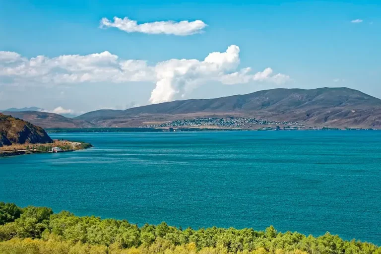
Не путайте это с озером Акналич (также пишется Акна) в провинции Армавир — это небольшое равнинное озеро на Араратской равнине, совершенно другое место. Акна в этом путеводителе — это высокогорное кратерное озеро в Котайке.
Where Is Lake Akna?
The lake lies on the Geghama volcanic plateau, the broad treeless highland that stretches between the Ararat Valley and Lake Sevan. Administratively it’s in eastern Kotayk Province, with the nearest village — Sevaberd — about 60 km east of Yerevan. On maps search for “Akna Lake Geghama” or the Armenian Ակնա լիճ; a plain “Akna” search will often send you to the wrong lake.
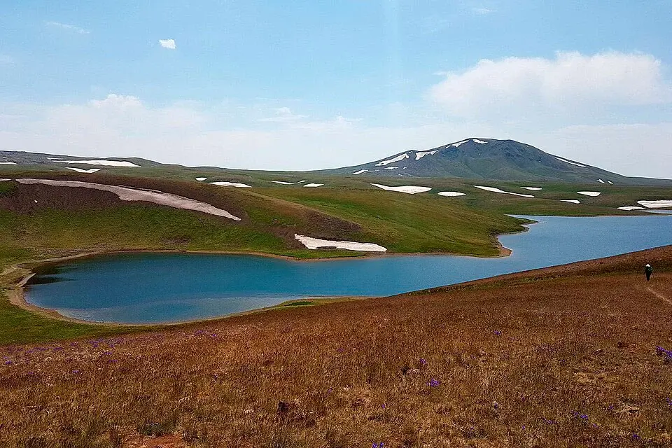
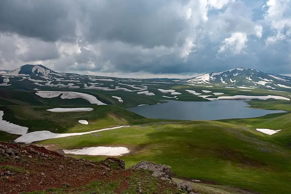
The plateau itself is a high volcanic landscape between 2,800 and 3,500 m, studded with old craters, lava fields and scatterings of obsidian. Akna lies inside one of those craters, with low grassy banks and turquoise water ringed by rocky ridges. It’s the largest body of water by surface area in the entire Geghama range, and it’s on Armenia’s official list of state-protected natural monuments.
What “Akna” Means
The name comes from the Armenian word akn (Ակն), meaning “eye” or “spring”. Looking down on the lake from the surrounding hills, the comparison is obvious — a single clear pupil set into the volcanic plateau. The same root appears in many Armenian place names tied to water sources.
Why Visit Lake Akna
A crater lake on a volcanic plateau. Akna isn’t just “a lake in the mountains” — it’s a body of water inside a true volcanic crater, surrounded by a lunar landscape of dark stone, obsidian fragments and not a tree in sight. There’s nothing else quite like it in Armenia.
Bronze Age petroglyphs. The Geghama plateau holds one of the largest concentrations of rock art in the Caucasus. The carvings around Akna and along the trails — animals, hunting scenes, solar and lunar symbols, human figures with raised arms — are between 3,000 and 5,000 years old. They aren’t behind glass: they’re sitting on basalt boulders out in the open, and you walk straight past them.
Vishap stones. The Geghama range is also famous for vishap stelae — Bronze Age “dragon stones” carved with serpent or fish motifs, typically placed near springs and high-altitude water sources. They’re an archaeological feature unique to Armenia and a few adjacent regions, and several stand around the Geghama plateau within a few hours’ walk of Akna.
Total autonomy. No café, no signpost, no rescue post, no reliable mobile signal. For experienced hikers that’s the appeal — a genuine wilderness trek two hours’ drive from the capital.
Astrophotography. At 3,000 m, with no artificial light for tens of kilometres in any direction, it’s one of the country’s best skies for stargazing. The Milky Way is plainly visible to the naked eye.
How to Get to Lake Akna
Yerevan → Sevaberd (by car): about 60 km, 1 to 1.5 hours of driving, on paved road all the way. Any normal car makes it to Sevaberd without trouble.
Sevaberd → trailhead (gravel track): a rough mountain track climbs from Sevaberd onto the plateau. In dry conditions (July–August) a high-clearance vehicle can drive another 5–8 km up, shortening the walk. After rain it’s strictly 4×4 — and even then not always passable. Conditions change every year; check with locals or with us before setting out.
If you don’t have your own off-road vehicle, the cleanest way is a car with driver in a 4×4 — the driver takes you as far as the track allows and meets you at a pre-arranged time. For groups, a minivan with driver to Sevaberd plus a transfer to a 4×4 from there is usually the simplest setup.
On foot to the lake: from the end of the drivable track, the lake is roughly 10–13 km one way, with 500–700 m of vertical gain depending on where the car stops. Allow 4–6 hours including breaks for the terrain and the altitude. The route isn’t waymarked — bring a GPS track and an offline map (maps.me or OsmAnd). Cairns and 4×4 ruts give some help, but don’t rely on them alone.
There are no reliable water sources along the climb. Carry everything you’ll need — at least 2 litres per person on the way up.
Public transport: none. Taxis run from Yerevan to Sevaberd; beyond Sevaberd it’s a private 4×4 or your own legs.
The Akna → Azhdahak Extension
For trekkers willing to give it more time, Akna is the classic gateway to Mount Azhdahak (3,597 m), the highest peak in the Geghama range. The mountain has its own crater lake right on the summit — a near-perfect rust-rimmed basin filled with ice-cold meltwater all summer.
From Akna it’s roughly half a day’s hike up to the Azhdahak summit and back, on a route used by the Transcaucasian Trail. A common three-day plan is: day one Sevaberd to Akna and camp; day two summit Azhdahak and return to camp (or continue to Vanqi Lake); day three descend toward Geghard or Geghaberd. It’s the most photographed line in the Geghama Mountains and the one most experienced trekkers come for.
When to Visit
June — snow may still linger in shaded craters and the track is often muddy. Only experienced hikers.
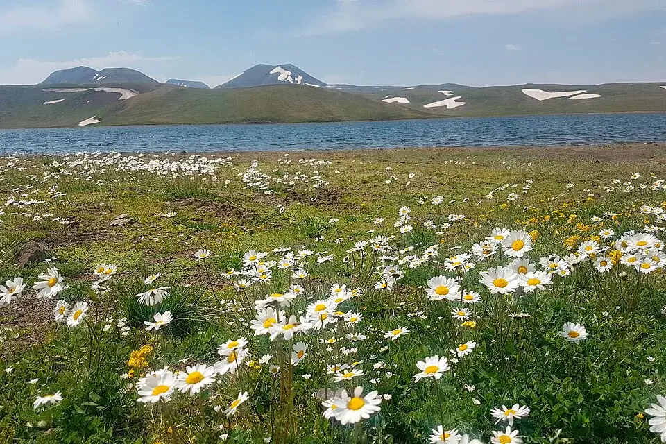
July–August — the best window. Snow is gone, meadows are green, wildflowers are out. Daytime +10…+18 °C, nights around 0…+5 °C. The gravel track is in its best shape of the year.
September — dry, clear air, golden grasses. Nights drop to −5 °C and the daylight window is shorter. First snow can fall by the end of the month.
October and later — for prepared expeditions only. Snow, wind, short days.
A note on altitude. Going from Yerevan (860 m) to a 3,000 m camp in a single day is felt. Expect shortness of breath under a pack and possibly a mild headache. Drink, walk at your own pace, and add an acclimatisation night if you can.
Camping at Lake Akna
The banks are flat and grassy — easy to pitch on. The most sheltered spots are on the eastern and southern shores, partly out of the prevailing west wind.
What to plan for: even in July, night temperatures at 3,000 m drop to 0…+5 °C, so bring a sleeping bag rated to about 0 °C comfort and a proper insulated mat. The plateau is exposed, so a wind-stable tent matters. Don’t plan on a fire — there’s no fuel up there and the ecosystem is fragile; bring a gas stove.
Water from the lake is generally considered clean, but filter or treat it to be safe. Pack out everything you bring in — leave no trace.
What to Bring
For a day hike: proper trekking boots (not sneakers — there’s loose rock), a windbreaker, a fleece, a rain shell, hat, sunglasses and high-SPF sunscreen, at least 2 litres of water per person, lunch, a downloaded GPS track plus a power bank, a head torch in case you run late, and a basic first-aid kit.
For an overnight: tent with solid wind resistance, sleeping bag (comfort 0 °C), insulated mat, gas stove and canister, cookware, water filter or purification tablets, warm base layer for sleeping.
Phone signal on the plateau is patchy. Tell someone at home your route and your expected return time.
One-day and Two-day Itineraries
One day (for fit hikers): very early start from Yerevan (5–6 a.m.), drive as far up the gravel track as conditions allow, hike to Akna (4–6 hours), an hour or two at the lake, descend and return to Yerevan by evening. Intense — best for people comfortable with 25+ km in a day.
Two days (the recommended pattern): day one drive and hike to Akna, set up camp, sunset and stargazing. Day two sunrise, a short side hike across the plateau (petroglyphs and neighbouring craters, or up to Azhdahak), descend, return to Yerevan.
Either itinerary fits naturally with a stop at Garni Temple and Geghard Monastery on the way out from Yerevan, or with Lake Sevan on the eastern side of the range as a finish. A private day tour is the easiest way to handle the logistics if you want everything pre-arranged.
Who Will Enjoy the Trip
Lake Akna isn’t a casual sightseeing stop. It rewards trekkers with day-hike or multi-day experience, landscape and night-sky photographers, anyone interested in Caucasus prehistoric archaeology, and travellers who genuinely want to disappear from civilisation for a day or two. Fitness should be moderate to high — 20+ km with a pack at 3,000 m takes real effort. Not recommended for children under about 12–14.