Lake Kari

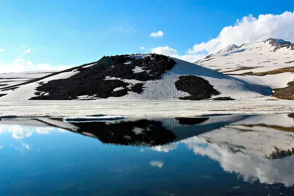
Lake Kari (also Kari Lake or “Stone Lake” — from Armenian Քարի լիճ) is a small glacial lake on the southern slope of Mount Aragats, Armenia’s highest mountain. It sits at 3,207 m above sea level, which makes it the highest point most travellers ever reach in the country — and the only one of that altitude you can drive right up to. The road climbs past Amberd Fortress, alpine meadows and stone fields, and ends at a turquoise basin ringed by Aragats’s four summits. A full day from Yerevan, but a serious one — you’ll cross from 1,000 m to over 3,200 m in two hours.
Quick Facts
- Location: Mount Aragats southern slope, Aragatsotn Province
- Also known as: Lake Kari, Kari Lake, Stone Lake, Քարի լիճ
- From Yerevan: ~70 km from Yerevan
- Depth: 9–10 m
- Elevation: 3207 m
- Entrance fee: Free
- Time needed: Full day
- Best time to visit: June – October
- Status: Natural monument
- GPS coordinates:
40.473878, 44.181315
Why Visit Lake Kari
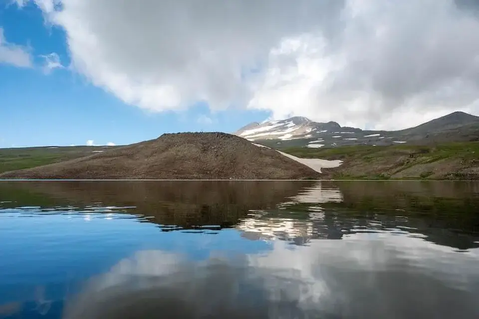
The point of Lake Kari isn’t the lake itself — it’s the altitude and the air. You stand above 3,200 m, there are no trees, only rock, grass and sky. In still weather the lake mirrors the summits of Aragats so cleanly it’s hard to tell where the water ends and the sky begins. Even in July the temperature at the lake can be 15–20 °C cooler than Yerevan — a serious contrast in the middle of a heatwave.
For most visitors this is the highest place they will ever stand in Armenia. The thin air is real: the sun is sharper, the wind colder, and walking up a slope makes you breathe faster. It’s not a hike — it’s a different climate world an hour and a half from the capital.
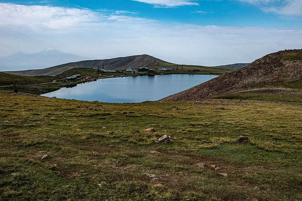
Next to the lake stands the Aragats Cosmic Ray Research Station. Many tour blogs call it an “abandoned Soviet observatory” — it’s neither. It was founded in 1943 by the Alikhanyan brothers as a high‑altitude physics laboratory and is still active today as a branch of the Yerevan Physics Institute. You can’t go inside, but the buildings against the mountain backdrop are a striking photo subject.
When to Visit — the Road Season
The mountain road to Lake Kari typically opens in early June and closes in late October. Exact dates depend on snow — in a long winter, opening slips later. In winter and early spring the road is buried under snow and not cleared.
- June: road open, snow patches still on the slopes, lake possibly still partly iced in early June. Few tourists.
- July – August: peak season. Daytime lake temperatures +10…+18 °C while Yerevan is +35…+40 °C. Alpine flowers, seasonal cafés operating. Weekends can be busy.
- September – early October: quieter, clearer air, softer light for photography. Weather more variable.
- Late October onwards: road may close any day.
Weather warning: at 3,200 m conditions flip fast. A sunny morning can turn into fog, wind and +5 °C in half an hour. Bring warm layers regardless of the forecast in Yerevan.
How to Get to Lake Kari from Yerevan
By car: ~70 km, 1 h 40 min – 2 h. Route: Yerevan → M1 highway to Ashtarak → turn off to Byurakan → past Amberd Fortress → mountain switchbacks up to the lake. First 55 km good asphalt; the final 12–15 km is a narrow, unguarded mountain road with some potholes after winter. A regular sedan handles it fine in dry weather; after rain be careful on the switchbacks.
With a private driver: the easiest option for visitors. A car with driver in Yerevan lets you stop at Amberd on the way and adjust the schedule to weather. For families or small groups a minivan is more comfortable on the switchbacks.
As part of a tour: Lake Kari is a standard inclusion in day tours from Yerevan, usually combined with Amberd Fortress and sometimes the Byurakan Observatory.
Public transport: there is no direct service. Marshrutkas reach Ashtarak; from there it’s another ~35 km of mountain road with no regular transport. Private transport is the only practical option for this direction.
Parking: free open area at the lakeside, next to the cosmic ray station. Refuel before leaving the highway — the nearest petrol is in Ashtarak.
What to Do at the Lake
- Walk around the lake — easy 1.5 km loop along the shore, 30–50 minutes, flat. The standard activity for almost everyone.
- Climb the nearby moraine — from the south shore a rocky ridge rises another 100–150 m. View opens onto the Ararat plain and all four Aragats summits. 20–30 minutes up but at 3,300 m your breathing is the limiting factor.
- Picnic — flat ground on the east shore. Seasonal cafés sometimes serve hot tea and khash, but their schedule is unpredictable — bring food.
- Photography — best light before 9 a.m. when there’s no wind and the lake reflects the peaks. A polarizing filter helps. Don’t forget the road itself — the Yerevan‑side switchbacks with Mount Ararat in the distance are one of Armenia’s best road shots.
Swimming: technically possible, practically no. The water stays around 5–8 °C even at peak summer.
Altitude and What to Bring
3,207 m is enough to feel. Mild shortness of breath on climbs is normal and passes. If you flew into Yerevan the same day, the effect can be stronger — move slowly, drink water, take breaks. People with serious cardiovascular issues should talk to a doctor first.
Pack: wind shell, fleece or warm sweater, a beanie or buff (yes, even in July), sunglasses and high‑SPF sunscreen (UV is much stronger at this altitude), shoes with grip (the shore is rocky), at least 1 L of water and a snack, basic first aid (something for a mild altitude headache), an offline map. Cafés may be closed — assume nothing.
Climbing Mount Aragats from Lake Kari
Lake Kari is the classic trailhead for Aragats summits. The South Peak (3,879 m) is the most accessible — a 3–4 hour ascent from the lake, no technical gear required, just stamina and good weather. The North Peak (4,090 m) is the highest point in Armenia and a much more serious undertaking — full day, fitness, and ideally a guide. Both routes start from the lake parking and are weather‑dependent. Don’t attempt either in fog or storm.
What to Combine With
- Amberd Fortress — 11th‑century stronghold at ~2,300 m, directly on the route up
- Byurakan Astrophysical Observatory — Soviet‑era astronomy centre on the lower slopes, visits by arrangement
- Ashtarak — old town with 7th c. churches, bakeries and restaurants for lunch on the way back
- Gegharot Waterfall — high‑altitude waterfall on the opposite (northern) slope of the same mountain massif — a second Aragats route from the other side
FAQ
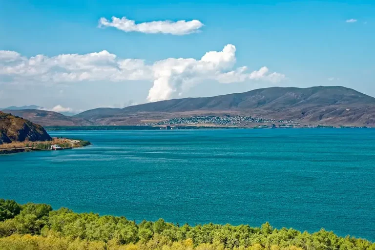
Lake Kari pairs naturally with the rest of the Mount Aragats area. The same massif also hosts Gegharot Waterfall on its northern slope — Armenia’s highest‑situated waterfall, accessed from a different side of the mountain. For Armenia’s other major lake, see Lake Sevan — the country’s largest, at much lower altitude. Full list of attractions in our things to do in Armenia hub.