Mount Artanish

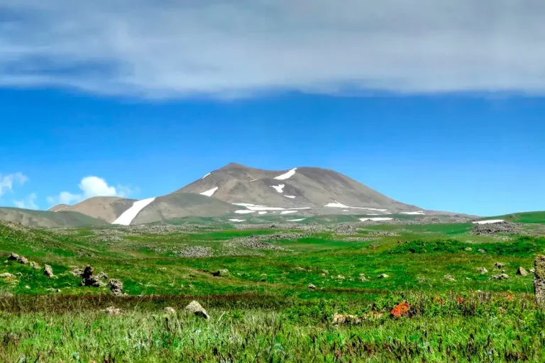
Mount Artanish (Armenian: Արտանիշ) is a 2,461-metre peak on the Artanish Peninsula in the centre of Lake Sevan, and the only summit in Armenia from which the whole of Lake Sevan is visible — both the Greater and the Lesser Sevan, split by the narrow channel between the Artanish and Noradus headlands. It is one of the most accessible mountain hikes in the country: a 540-metre climb of 2.5 to 3 hours from the trailhead, no technical sections, and a 360-degree view from the summit that takes in four mountain ranges plus the lake itself.
Quick Facts
- Location: Artanish Peninsula, Gegharkunik Province
- Also known as: Artanish Mountain, Mount Artanish, Արտանիշ լեռ
- From Yerevan: About 95 km
- Elevation: 2,461 m
- Entrance fee: Free
- Time needed: 5–7 hours on trail; full-day trip from Yerevan
- Best time to visit: May–October
- GPS coordinates:
40.4813889, 45.3080556
About the mountain
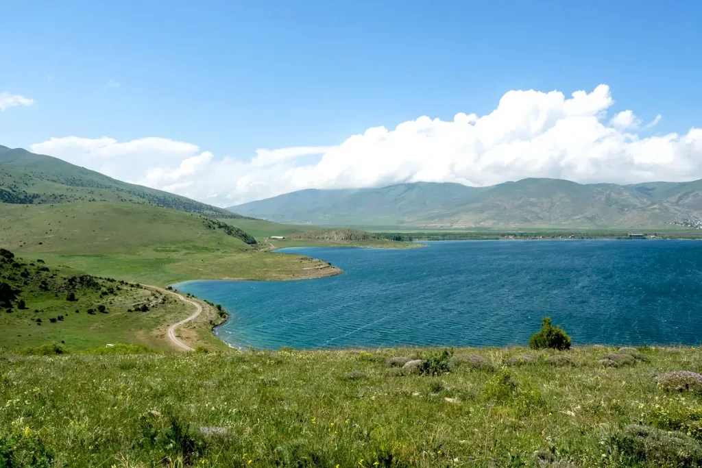
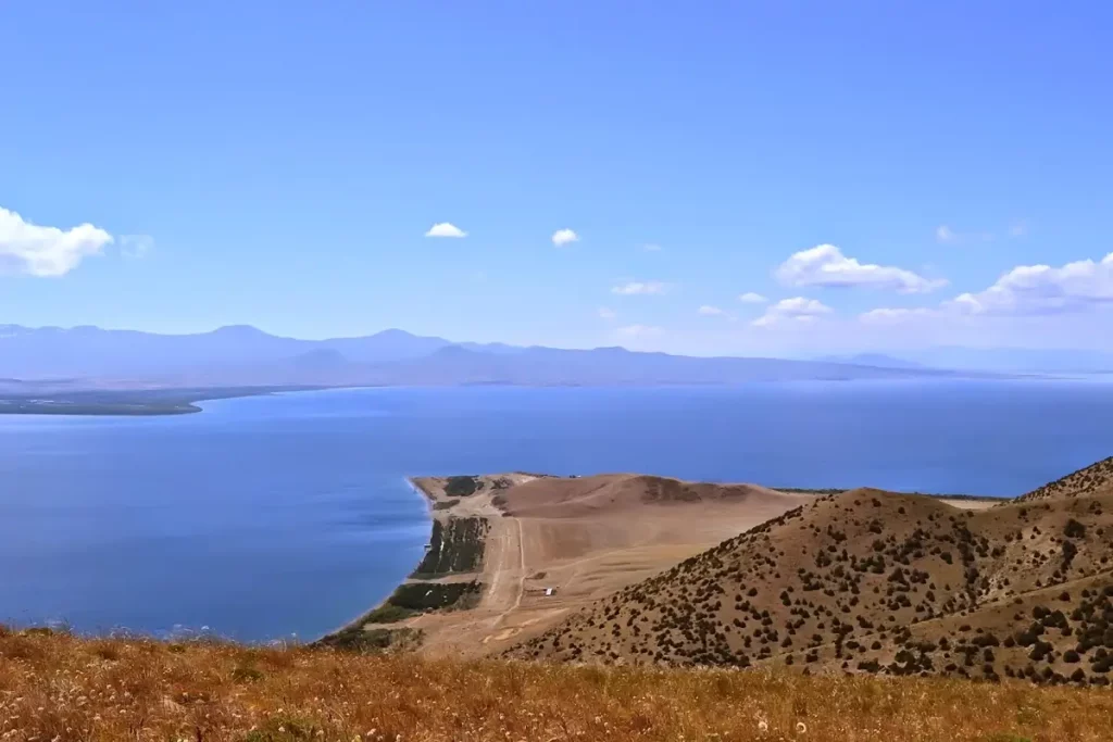
Artanish sits inside Sevan National Park in Gegharkunik Province, on the peninsula of the same name that pushes south into the lake from the north shore and divides Sevan into its two basins — Greater Sevan to the south and Lesser Sevan to the north. The lake itself lies at roughly 1,900 metres above sea level, so the summit at 2,461 metres rises only about 540 metres above the water. That low relative height is what keeps the climb manageable; what makes the view so unusual is the peninsula’s central position.
The mountain is volcanic in origin, like most of the peaks around Sevan, but does not belong to any named range. The slopes are rounded, covered with subalpine meadows in summer and steppe vegetation lower down, with no rocky obstacles along the standard route. The peninsula and the mountain are a strict-protection zone of the national park, which means no campfires and pack-out rules for all rubbish — easy enough to respect, but worth mentioning before a casual visit.
From the summit, four ranges are visible: the Pambak range to the north-west, the Geghama range to the south-west, the Vardenis range to the south and the Areguni range to the east. But the headline view is the lake itself: in clear weather, the eye runs from the southern end at Vardenis all the way to the narrow northern bay at Lichk, with the Noradus headland directly across the channel — about five kilometres of open water at its narrowest point.
The trail to the summit
Technically the climb is a Grade 1 outing — the easiest level. No ropes, no scrambling, no specialised gear. The standard route follows a grassy slope from the base of the peninsula up to a broad summit platform with a small triangulation marker and a low stone cairn on top. From the trailhead to the top is about six kilometres in one direction, with roughly 540 metres of elevation gain spread out over a moderate gradient.
Trail at a glance:
- Trailhead: about 4 km southwest of Artanish village, where the dirt road meets the foot of the ridge; some groups start near Shoghakat village
- Distance: 6 km one way, 12 km round-trip
- Elevation gain: ~540 m (some sources cite 560 m)
- Time up: 2.5–3 hours
- Time down: 1.5–2 hours
- Total day (with breaks): 5–7 hours
- Difficulty: easy to moderate, no special equipment
- Best season: June to September
There is no water source on the trail — bring 1.5 to 2 litres per person in the warm months. Wind on the summit is almost a constant: even in midsummer, a north-easterly comes off the lake and the air at the top runs noticeably cooler than at the trailhead, so a windproof shell goes in the pack on every climb. On the descent you can use the solar power station below as a visual landmark to keep your line.
After the climb most groups walk down to the shore of Sevan to swim. The water around the Artanish peninsula is some of the cleanest in the whole lake, because this part of the shoreline is undeveloped, and there are several pebble beaches within five kilometres of the trailhead.
When to go
- June–September. The reliable hiking window. Trail is dry, slopes are green, summit temperatures sit at 15–20 °C in the daytime, and after the climb you can swim in the lake. June adds wild flowers on the slopes; September gives the softer light and warmer earth tones that photograph best.
- May and October. Shoulder months. Patches of snow can linger on the upper slopes into May; in October the summit is already cold and windy, but the views toward Sevan are often the most dramatic of the year — low cloud sits over the lake, light is golden, and visibility tends to be excellent.
- November–March. The mountain is short enough that experienced winter hikers do climb it year-round; on a calm sunny day the summit panorama with a frozen-edged Sevan beneath it is hard to match. Snow on the trail, strong wind from the lake and the occasional storm make crampons, a proper warm layer and a margin of caution non-negotiable. This is not a beginner outing in winter.
Sevan weather changes faster than the rest of the country — check the forecast on the morning of the climb, and turn back early if the sky over the lake starts building up.
Difficulty and who the hike suits
Artanish is one of the easiest summit hikes in Armenia, and a good first mountain in the country for visitors who have not climbed at altitude before. The slope is gentle, there are no exposed sections, and the total elevation gain is small. The factors that can still make the day harder are:
- the wind on the summit, which is almost guaranteed and can be biting even in July
- the lack of shade anywhere along the trail
- the lack of water sources between the trailhead and the top
- the fact that the trail is not marked — you need an offline map or a guide
Families with older children, trail runners, and anyone in basic walking fitness can do this climb comfortably. It is also a good shoulder-season alternative to higher mountains when Aragats or Azhdahak are still snowed in.
What to bring
- Hiking shoes with a grippy sole; trekking poles useful but not essential
- Windproof shell, even in midsummer — the summit is exposed to lake wind year-round
- A warm layer for the summit and the descent
- 1.5–2 litres of water per person
- Offline map or GPX track, power bank, head torch
- Sun protection: sunglasses, sunscreen, a hat
- Snack or trail food — there are no cafés or shops on the trail or in the lower villages
- Swimwear and a towel if you plan to dip in Sevan after the descent
- In winter: crampons or micro-spikes, an extra warm layer, gloves and a beanie
Safety
- Wind on the summit ridge is the main constant. If the wind on the upper slope is strong enough to push you off balance, turn back without trying for the summit.
- No water on the trail. Carry everything you need. The nearest reliable water source is at the lake itself, after the descent.
- Open exposure to sun. No shade anywhere — sunscreen, a hat and sunglasses are not optional from May to September.
- Lightning. Afternoon thunderstorms develop over the lake in summer; if cloud is building, leave the ridge.
- Trail finding. None of the trails on Artanish are signposted. Download an offline map and a GPX track before you set off, and never rely on cellular coverage — it cuts in and out across the peninsula.
- Cold-water swimming. If you dip in Sevan after the climb, remember the lake sits at almost 1,900 metres and the water is much colder than the air feels — even in August.
How to get to Mount Artanish from Yerevan
From Yerevan the drive is around 95 km and 1 hour 45 minutes in normal traffic. Take the M-4 north toward Sevan, then follow the lake-loop road north along the eastern shore in the direction of the village of Shorzha and the village of Artanish. From the village a dirt road continues another few kilometres south-west to where the trail starts at the foot of the ridge.
The trailhead is not signposted. In dry weather a standard saloon car can reach the start of the trail; after rain a higher-clearance vehicle is more comfortable on the last few kilometres of stony dirt road.
Public transport is impractical: minibuses from Yerevan run only as far as Sevan town and Martuni, with no onward service into the peninsula. Most visitors come on a Lake Sevan day tour with hiking included, or hire a car with driver for the day — the driver waits at the trailhead while you climb and can drop you at a beach for swimming afterwards.
What to see nearby
The Artanish climb pairs naturally with the other classic Sevan sights:
- Lake Sevan itself — beaches, fish restaurants, watersports, and the dramatic mountain-lake scenery that surrounds the climb.
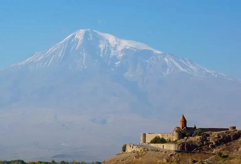
- Sevanavank Monastery — the 9th-century complex on the Sevan Peninsula on the southern shore, about 50 km away around the lake-loop road. The natural end point of a Sevan day if you start with the climb.
- Hayravank Monastery — the 9th-to-10th-century church on the western shore, about 60 km away.
- Noratus — the world’s largest field of khachkar (Armenian cross-stones), about 70 km away on the southern shore.
- Lakeshore guesthouses at the base of the Artanish peninsula — useful if you want to start the climb early or split the day in two.
A clean one-day plan from Yerevan: Mount Artanish (hike) → swim or beach time on Sevan → Sevanavank on the drive back. About ten hours door to door. The same itinerary works as part of an individual tour with a driver-guide.
Frequently asked questions
Mount Artanish does not have a famous legend, a crater lake or a snow line on the summit. What it has is the view: the whole of Lake Sevan in a single panorama, framed by four mountain ranges, after an honest half-day climb. For travellers who want one proper mountain day in Armenia and a swim in the lake afterwards, it is hard to think of a cleaner choice.