Mount Ara
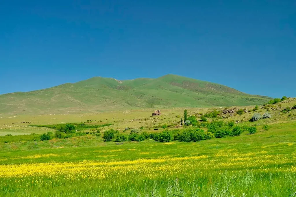
Mount Ara, also known as Aralеr (Armenian: Արայի լեռ, “Ara’s mountain”), is an isolated extinct volcano 36 kilometres north of Yerevan and one of the most distinctive silhouettes in the Armenian landscape. From the highway between Yerevan and Lake Sevan the ridge of the mountain looks unmistakably like a man lying on his back with his hands folded on his chest — the source of the local nickname the Lying Giant of Armenia and of one of the oldest mythological stories in the country.
Quick Facts
- Location: Between the Kasakh and Hrazdan valleys, Aragatsotn and Kotayk provinces
- Also known as: Araler, Arai Ler, Arailer, Arayi Ler, the Lying Giant of Armenia, Արայի լեռ
- From Yerevan: About 50–70 minutes by car
- Elevation: 2577
- Entrance fee: Free
- Time needed: 4–6 hours hiking; full day with the drive
- Best time to visit: May to October
- Status: Extinct volcano
- GPS coordinates:
40.4015, 44.4618
About the mountain
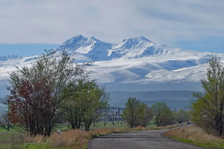
Mount Ara rises to 2,577 metres above sea level on the border between the Aragatsotn and Kotayk provinces, between the valleys of the Kasakh and Hrazdan rivers. It is a polygenetic stratovolcano with andesite-basaltic rocks; its last activity ended long before humans reached the Armenian Highlands. Because the mountain stands on its own — not part of any larger range — it is visible from much of central Armenia, and its outline is one of the easiest mountains to recognise on the country’s skyline.
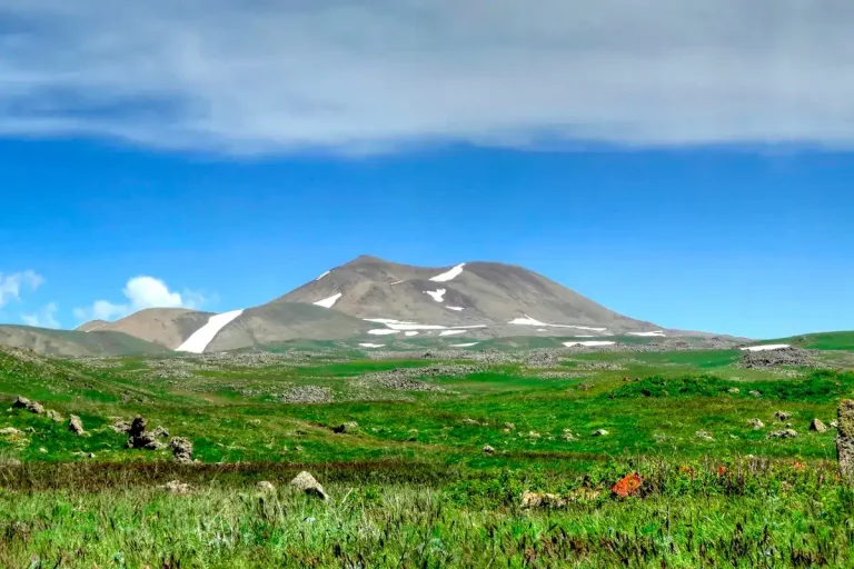
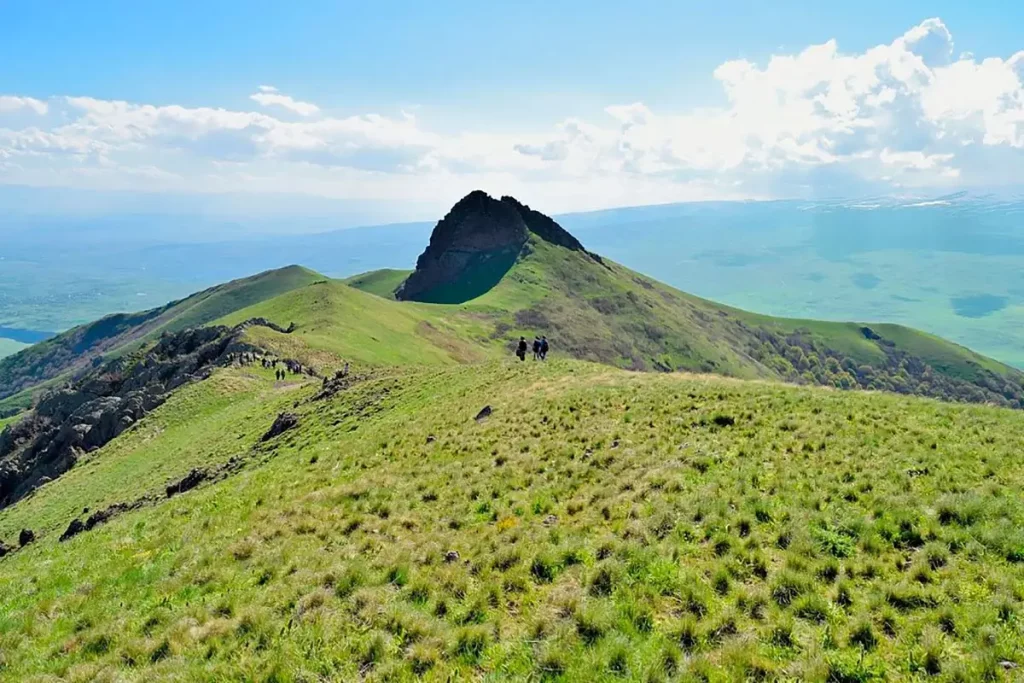
The summit forms a ring-shaped crater in an irregular ellipse with a truncated top. Inside the crater, in a sheltered depression, a flower meadow blooms each year in late April and May — red poppies, irises and mountain tulips — which is one of the main reasons spring is the favourite season for the climb. Around 650 plant species have been catalogued on the slopes of Mount Ara, roughly 20 per cent of the entire flora of Armenia — an exceptional biodiversity figure for a single mountain. The lower slopes carry steppe vegetation, the upper slopes subalpine meadow, and the area is also designated as an Important Bird Area, with golden eagles and Caucasian black grouse among the species recorded here.
A small note of history: the mountain’s older Armenian name is Tsaghkevank (“monastery of flowers”). That name was eventually pushed off the mountain itself by the Ara legend and survives today on the cave-chapel of Saint Varvara on the southern slope, which is still called Tsaghkevank Monastery.
The legend of King Ara the Beautiful
The name Ara comes from one of the oldest stories in Armenian mythology, recorded by the 5th-century historian Movses Khorenatsi.
According to the legend, the Assyrian queen Semiramis (Armenian: Shamiram) heard of the beauty of the Armenian king Ara and sent a delegation to Yerevan asking him to marry her and unite the two kingdoms. King Ara refused. Furious, Semiramis raised an army and marched against Armenia. Despite her orders to take Ara alive, in the battle at the foot of this mountain he was mortally wounded.
Semiramis ordered his body to be carried to the summit and prayed there to the aralez — winged dog-like spirits of Armenian mythology, believed to revive warriors fallen in battle by licking their wounds. The aralez did not come. According to the story, the body of the king remained on the summit and slowly turned into the mountain itself; the village at the foot of the slope was named Arai-gyukh (“Ara’s village”), and the mountain became Arai-ler (“Ara’s mountain”). Seen from the right angle — most clearly from the road between Yerevan and Lake Sevan — you can read the silhouette as a head, a chest, folded arms and outstretched legs.
The legend has been part of how Armenia thinks about itself for more than fifteen hundred years, and the mountain still holds a quiet ceremonial weight today: on 24 April, the day of remembrance of the victims of the Armenian Genocide, several hundred people climb to the summit each year as a personal act of memory. Visitors planning a hike on that date should expect the trail to be unusually busy.
The trail to the summit
The climb of Mount Ara does not require ropes, alpinism or any technical gear. The standard route follows gentle grassy slopes and broad ridge platforms — no scree gullies, no exposed scrambling — and is one of the easiest “real summit” outings in the country for anyone in normal physical condition.
Trail at a glance:
- Trailhead: village of Aragyugh, Saralanj, Antaravt or Kakavadzor (Kotayk side), or Yernjatap / Saghmosavan (Aragatsotn side)
- Distance: about 9 km round-trip on the classic line
- Elevation gain: ~550 metres
- Time up: 2.5–3 hours
- Time down: 1.5–2 hours
- Total day (with breaks): 5–6 hours
- Best season: April to October
- Difficulty: easy to moderate, no special equipment
The most popular line climbs the southern slope and descends on the eastern side via a rocky, wooded ravine to Tsaghkevank Monastery — a small cave chapel of Saint Varvara dug into the mountainside. The chapel is a pilgrimage point with a spring, and it makes a natural conclusion to the day before driving back to Yerevan.
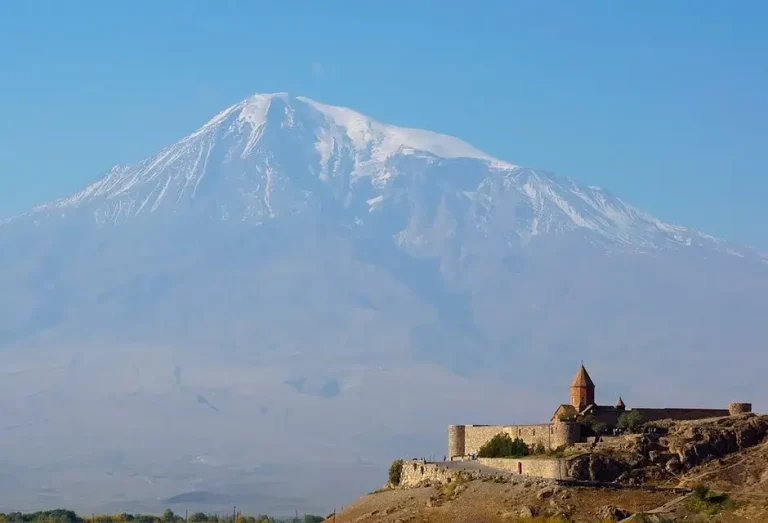
From the summit a clean all-round panorama opens: Mount Aragats to the north, Mount Ararat and Little Ararat across the plain to the south, the Armavir plain to the west, and the western ridges of the Geghama range to the east. In clear weather the view is among the best in the country — exactly because Mount Ara stands alone in the middle of the plain.
The summit catches strong wind, especially in spring and autumn — a windproof layer is worth packing even in midsummer.
When to go
- April–May. The flower window. Snow has cleared from the slopes by mid-April, and the crater meadow and southern slopes fill with poppies, irises and tulips. Mornings on the summit are still cold.
- June–September. The most reliable season. Dry trail, green slopes, summit temperatures of 15–22 °C in daylight. Views toward Ararat tend to haze over in midday — start at dawn if the panorama is the priority.
- October. Golden autumn light, the cleanest Ararat views of the year, fewer people on the trail. Cool — pack a warmer layer.
- November–March. The mountain holds snow on the summit and the ridge. The climb is possible for hikers with winter experience and proper kit (crampons, ice axe, layered clothing), but it is no longer a beginner outing.
Difficulty and who the hike suits
Mount Ara is a moderate day hike on open terrain. It suits first-time visitors with basic fitness, families with older children, and trail runners. The trail itself does not have technical sections in summer conditions; the difficulty drivers are the wind on the exposed summit, the heat in July and August (the slopes are completely shadeless), and the lack of any water source along the route.
What to bring
- Hiking shoes or trail runners with a grippy sole; trekking poles useful but not essential
- Windproof shell and a warm layer for the summit; a light rain jacket in summer
- 1.5–2 litres of water per person — there are no reliable water sources on the trail
- Offline map or GPX track, head torch, power bank
- Sun protection: sunglasses, high-SPF sunscreen, a hat or cap
- Snack or trail food — there are no cafés or shops along the way
- In shoulder season and winter: micro-spikes or boot chains, warm gloves and a beanie; in deep winter, an ice axe and crampons
Safety
- Wind on the summit. The ridge picks up wind from both river valleys; perceived difficulty rises sharply on windy days. If wind is strong enough to push you off balance, do not insist on the summit — turn back early.
- No water on the trail. Carry everything you need; the nearest reliable spring is at Tsaghkevank Monastery on the descent.
- Sun and heat. The slopes are completely shadeless. In summer, start at first light and watch for early signs of dehydration.
- Navigation. Trails on Mount Ara are not signposted (this is true across nearly all Armenian hiking routes). Download an offline map and a GPX track before you set off.
- Lightning. Afternoon thunderstorms build up over the plain in summer — at the first sign of cloud build-up, leave the ridge.
- Mobile coverage is patchy on the slopes and reliable only near the summit; do not depend on cellular signal for navigation.
How to get to Mount Ara from Yerevan
From Yerevan take the M-3 highway north toward Ashtarak and Byurakan (the same turn-off as for the famous Byurakan Astrophysical Observatory). From Byurakan the road continues toward the villages of Antaravt or Kakavadzor, from where a dirt road leads to the foot of the mountain. From central Yerevan the drive is roughly 60 minutes.
The trailhead itself is not signposted. In dry weather a regular saloon car will reach the start of the trail, but after rain the last stretch of dirt road is more comfortable in a higher-clearance vehicle.
The simplest way to do the climb as a day trip from Yerevan is with a car with driver — you can be dropped at the trailhead, picked up on the other side after the descent to Tsaghkevank, and combine the hike with one of the nearby monasteries on the way back. The same logic works as part of a private day tour from Yerevan.
Public transport does not reach the trailhead: minibuses from Yerevan only run as far as Ashtarak and Byurakan.
What to see nearby
Mount Ara sits inside one of the densest sightseeing clusters in Armenia. Within a 15–25 minute drive:
- Tsaghkevank Monastery — the cave chapel of Saint Varvara on the southern slope of Mount Ara itself, a natural endpoint after the descent.
- Hovhannavank Monastery — a 13th-century complex on the edge of the Kasakh canyon, around 15 km away.
- Saghmosavank Monastery — Hovhannavank’s twin, also on the canyon rim, around 18 km away.
- Byurakan Astrophysical Observatory — the centre named after Viktor Hambardzumyan, about 10 km away.
- Saint Zoravar Church of Aruch (Aruchavank) — a 7th-century church in the village of Aruch, around 12 km away.
- Ashtarak — the town below Mount Aragats with old bridges across the Kasakh and a strong panorama of the Aragats massif.
- Neighbouring peaks: Mount Hatis, the volcanic cone directly across the valley to the east (and the other half of the Ara–Shamiram legend), and Mount Gutanasar, the easier starter volcano in Kotayk.
A natural one-day itinerary from Yerevan combines Mount Ara (hike) → Tsaghkevank Monastery → Byurakan Observatory for a full day of around ten hours.
Frequently asked questions
Mount Ara is the most storied of the day mountains around Yerevan: an easy summit with a clean ring crater, a 360-degree panorama that takes in both Aragats and Ararat, and a legend that has carried the mountain’s name in Armenian for more than fifteen hundred years. Whether you climb it for the spring flowers, the autumn light or simply for the silhouette of the Lying Giant, it is one of the most rewarding short days a visitor to Yerevan can spend.