

Vanadzor
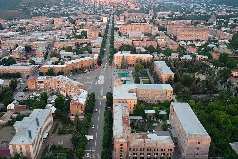
Vanadzor (Armenian: Վանաձոր) is the third-largest city in Armenia after Yerevan and Gyumri, and the administrative capital of Lori Province. It sits in the Vanadzor Basin, hemmed in between the Bazum Range to the north and the Pambak Range to the south, at the point where three rivers — Pambak, Tandzut and Vanadzor — meet. Elevation is around 1,350 metres; population around 75,000, on more than 25 km². The town has changed names twice: it was Karakilisa until 1935, then Kirovakan for the entire Soviet era, and finally Vanadzor since 1992.
Vanadzor is a city cradled in green. Whichever direction you look, forested slopes rise around you, and the town sits inside them as if in a bowl. For travellers, its real value is as the gateway to the north: from here it is a short drive to the UNESCO-listed monasteries of Haghpat and Sanahin, to the arboretum and medieval fortress at Stepanavan, and to the Dilijan National Park. From Yerevan, Vanadzor is 125 km — about an hour and a half to two hours by road.
Geography and climate
The Vanadzor Basin is wedged between two mountain ranges: the Bazum Range to the north and the Pambak Range to the south. Three rivers meet inside the town — the Pambak, the Tandzut and the Vanadzor — and flow on together to the Debed and the Kura. The southern and eastern edges of the town push straight into forest; the northern and western slopes give way to shrubland and alpine meadow.
The climate is mountain continental. Summers are cool and pleasant, with July averaging around +20 °C, and winters are cold, dropping to −5 to −10 °C. Vanadzor is noticeably cooler than Yerevan in summer and colder in winter. Humidity is also higher — the surrounding ridges catch and hold clouds — which gives the town its distinctive green colour through the warm months.
From Karakilisa to Vanadzor: a short history
The Vanadzor basin has been inhabited since the Bronze Age. Ancient burial mounds still stand on the Tagavoranist and Mashtots hills overlooking the town. In antiquity the area belonged to the canton of Tashir, part of Gugark Province in Greater Armenia.
The medieval settlement here was called Karakilisa — a Turkic name meaning “the black church,” from a black-stone church that stood on the site until 1828. In 1801 the region joined the Russian Empire together with the Kingdom of Kartli-Kakheti, and Karakilisa became a border garrison town. From the 1830s onwards, Armenian families displaced from Western Armenia — from Kars, Erzurum and Ardahan — settled here in large numbers, giving the town its modern shape.
In 1935 the Soviet authorities renamed the town Kirovakan, in honour of the Bolshevik leader Sergei Kirov. Under Soviet rule Kirovakan became one of Armenia’s key industrial centres, with large chemical and machine-building plants. By 1988 the population had reached 173,000.
On the afternoon of 7 December 1988 the Spitak earthquake struck the region. In Kirovakan the shaking was recorded at intensity 8. Residential blocks collapsed, hundreds of people were killed, and the industrial base of the town was largely destroyed. Some of the wrecked structures still stand as they were left in the days after. The city’s population began falling in the aftermath and has more than halved in the three decades since — from 173,000 to today’s 75,000.
In 1992 the town was renamed by referendum. In an unusual outcome, a majority of voters chose “Gugark” — the ancient province name — but the Supreme Soviet rejected it on historical grounds and approved the second most popular option, Vanadzor.
What to see in Vanadzor
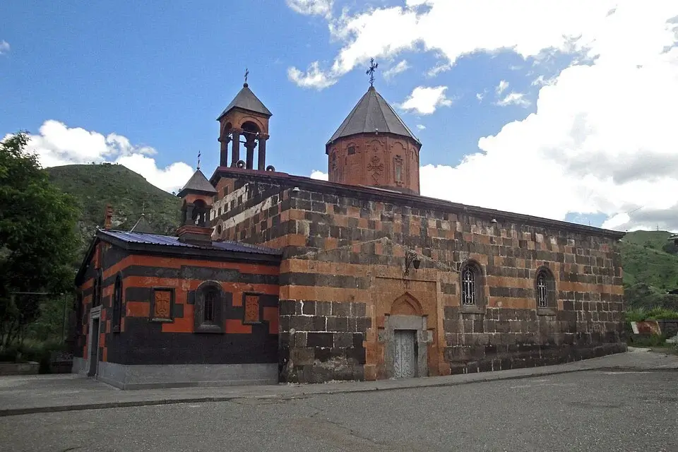
Surb Astvatsatsin Church
The town’s main historic building. A 19th-century church built in alternating courses of black and red tuff, on the site of the older “black church” that gave Karakilisa its name. A strong example of Armenian ecclesiastical architecture in the region’s traditional two-colour masonry.
Central Park and Pond
A shaded green space in the middle of the town with a pond where you can rent a boat in summer and skate in winter. The park is ringed with cafés and restaurants and is where locals gather in the evening.
Vanadzor Botanical Garden
A modest but well-kept collection on the southern edge of the town, focused on mountain and subalpine plants of Lori Province. Worth an hour if you’re interested in the local flora.
Kamakatar Chapel
A medieval chapel on a hilltop outside town — small but atmospheric, with a wide view over the whole basin. Reachable by an unpaved road.
Viewpoints
Vanadzor is completely surrounded by mountains, and several hills that ring the basin serve as viewpoints. The former Hotel Kirovakan on the hill above the town — a semi-abandoned Soviet-era building — is one of the best.
Vanadzor as a base for northern Armenia
For travellers, the real reason to spend a night in Vanadzor is what surrounds it. Within a 60-kilometre radius are several of the most important sights in Armenia.
Haghpat and Sanahin monasteries — 40–50 km north, in the Debed canyon. Two of the most important pieces of Armenian medieval architecture, dating to the 10th–13th centuries. Both are inscribed on the UNESCO World Heritage list.
Stepanavan — 30 km north. The 35-hectare Sosniaki Dendropark and the ruins of Lori Berd, the 11th-century royal capital.
Dilijan — 60 km east. Dilijan National Park, Lake Parz, and the medieval monasteries of Haghartsin and Goshavank.
Odzun — 30 km north. A 6th-century basilica standing alone on the edge of the Debed canyon, one of the oldest surviving churches in the region.
A comfortable two-day route from Yerevan runs: Yerevan → Vanadzor → Haghpat → Sanahin → Stepanavan (dendropark, Lori Berd) → Dilijan → Yerevan. This is easiest with a car with driver from Yerevan or as a private tour of Armenia.
Who Vanadzor suits
Travellers heading to the north — this is the most practical base for reaching Haghpat, Sanahin, Odzun, Stepanavan and the Debed canyon. Sleeping in Vanadzor turns a long day trip from Yerevan into a comfortable two-day loop.
Travellers interested in Soviet and post-Soviet history — Vanadzor tells the story of a large industrial city that lost most of its purpose in a single decade — the 1988 earthquake and the collapse of the Soviet Union — and is still visibly recovering. Very few Armenian towns wear this history as openly.
Anyone looking for green — after a few days on the sun-baked Ararat plain, the beech and pine forests around Vanadzor come as an unexpected relief.
Best time to visit
- Spring (April–May) — green mountains and comfortable temperatures. Rain is common.
- Summer (June–August) — the best season. Noticeably cooler than Yerevan, all roads open. This is when the “green cradle” effect is most striking.
- Autumn (September–October) — the forests of the Lori plateau turn gold and copper, and the air is clear and dry. Low tourist numbers.
- Winter — cold (−5 to −10 °C) with regular snow, but the roads stay clear and there are far fewer visitors. The mountains around the town look their best under snow.
How to get there
The distance from Yerevan to Vanadzor is around 130 km, and the journey usually takes about 2 hours. For a direct trip without changing vehicles, you can book a Yerevan to Vanadzor transfer: the driver will pick you up from your hotel, apartment or another address in Yerevan and take you directly to your hotel, guesthouse or another specified address in Vanadzor. Prices start from 40,000 AMD per vehicle.
Marshrutkas run from Yerevan’s Northern Bus Station every 30–60 minutes and cost around 1,500 AMD. Journey time is around 2.5 hours.
Train. There is a scenic rail service between Yerevan and Vanadzor. The rail route is longer — 224 km, about 3.5 hours — but climbs through the mountains and is one of the more atmospheric train rides in the South Caucasus. Slow, but worth it if you have half a day and no fixed schedule.
To reach Haghpat, Sanahin, Odzun or Stepanavan you need a vehicle — either a rental car, an organised transfer, or a driver from Yerevan who can fit Vanadzor into a two-day northern loop.
Frequently Asked Questions
See more on Armenia’s cities or plan the trip with a car with driver from Yerevan.