Trchkan Waterfall

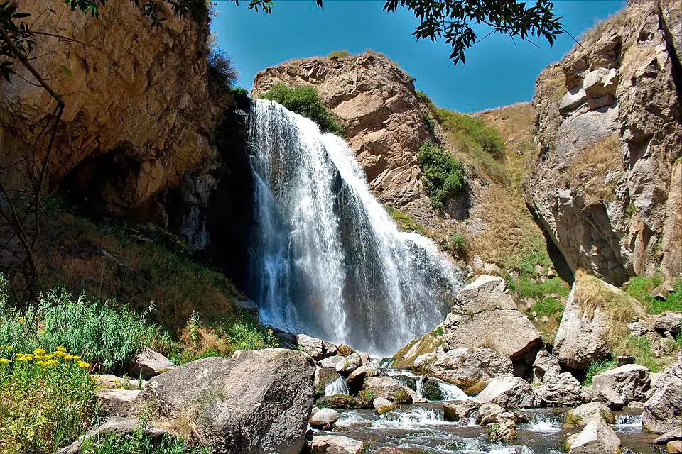
Trchkan Waterfall is the tallest vertical waterfall in Armenia — a 23-metre sheet of water dropping straight off a basalt cliff on the Chichkhan River, in a remote forested gorge on the border between Shirak and Lori Provinces in the north of the country. Smaller and harder to reach than the famous Jermuk and Shaki cascades in the south, Trchkan rewards the trip with raw scale, almost no crowds, and one unusual feature — a semi-cave directly behind the falling water that you can actually walk into. The waterfall is a protected natural monument of the Republic of Armenia, designated after a high-profile public campaign in 2011 saved it from a planned hydroelectric project. From Yerevan it’s about 180 km — usually visited together with Gyumri.
Quick Facts
- Location: Sarapat village, Shirak Province
- Also known as: Trchkan Waterfall, Chichkhan Waterfall, Trchkan Jur, Chran, Armenian Niagara, Տռչկան ջրվեժ
- From Yerevan: About 180 km / 2.5–3 hours (4x4 recommended for final approach)
- Height: 23.5 m
- Entrance fee: Free
- Time needed: 2 hours at falls + 1.5h hike each way from Sarapat
- Best time to visit: March–June (peak flow); avoid winter (road access unreliable)
- Status: Protected natural monument (since 2011)
- GPS coordinates:
40.916, 44.116
Armenia’s Tallest Vertical Waterfall
Trchkan is a single, almost perfectly vertical drop. The Chichkhan River — a left tributary of the Pambak — meets the edge of a basalt cliff and falls 23 metres (officially 23.5 m in the Armenian state register) in one straight column. There are no intermediate steps, no fanning curtain, no angle.
That detail matters because Armenia has two contenders for the title of “tallest waterfall.” Jermuk in the south is taller overall at around 70 metres — but it falls down three rounded limestone steps at an angle and is gentle rather than torrential, which is why some Armenian geographic sources do not classify it as a true waterfall. Trchkan, by contrast, is the country’s tallest single vertical drop, and is officially recognised as Armenia’s tallest waterfall by the Armenian Geographic Society. Locals also call it the “Armenian Niagara” because it is the most water-abundant waterfall in the country.
A few other practical details:
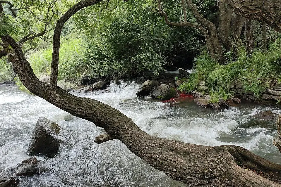
- Source: the Chichkhan River starts on the north-eastern slopes of the Shirak Mountain Range at around 2,250 m elevation. It runs 29 km east through the Bazum Mountain Range before joining the Pambak.
- Volume: the river is fed almost entirely by snowmelt and groundwater. The flow is at its strongest in spring and early summer, weaker in late summer and autumn.
- Sound: locals sometimes call the falls “Chran” — onomatopoeic for the roar of the water. Other names include Chichkhan Waterfall and Trchkan Jur (“Trchkan Water”).
The most distinctive physical feature of the site is the shallow cave directly behind the water curtain. You can walk along a narrow ledge and stand behind the falling water — a perspective you won’t get at any other major waterfall in Armenia.
The Legend of the Jumping Trout
The Armenian name Trchkan (Տռչկան) comes from the verb trchel — “to jump.” The most widely told story behind the name involves the trout that have always been abundant in the Chichkhan River.
According to villagers from Sarapat and the nearby settlements, during the spring spawning run they once watched trout jumping out of the river and somehow making it up over the 23-metre wall of falling water — a near-impossible biological feat. Whether anyone actually saw a trout clear the falls or whether the river simply ran so thick with leaping fish in spring that it seemed possible, the name stuck. Trchkan — “the place where they jump.”
The Chichkhan River was historically famous for its trout. Today the population is much smaller, but the name remains.
The 2011 Battle to Save Trchkan
For most of its history, Trchkan was a remote and barely known waterfall — a place visited by hikers, locals, and occasional birdwatchers. That changed sharply in 2011.
A private energy company received a license to build a small hydroelectric plant on the Chichkhan River that would have diverted most of the river’s flow into a turbine. The waterfall, in effect, would have been switched off — left as a dry rock face for most of the year, with only seasonal flow during peak snowmelt.
A coalition of environmental activists, local residents, and journalists organised public protests, court challenges, and a sustained media campaign. In late 2011 the Armenian government revoked the construction license and designated the waterfall and surrounding gorge as a protected natural monument. It remains one of the few major successes of environmental activism in modern Armenian history.
For visitors, the legal protection means the area is permanently safeguarded from industrial development. For locals, the story is part of why Trchkan now carries a slightly different weight than other natural sights in the country.
When to Visit
The Chichkhan River is fed by snowmelt and groundwater, so the volume changes dramatically through the year:
- March to June — peak flow. This is when the falls earn the “Armenian Niagara” nickname. Snowmelt from the Shirak Mountains pushes the river to maximum volume; the roar can be heard from a kilometre away. The best season for first-time visitors.
- July to August — moderate flow. The volume drops noticeably but the falls remain impressive. Comfortable hiking temperatures and the longest daylight.
- September to mid-October — reduced flow with autumn colour. The forested gorge turns golden. Good for photographers; the falls are smaller but still flowing.
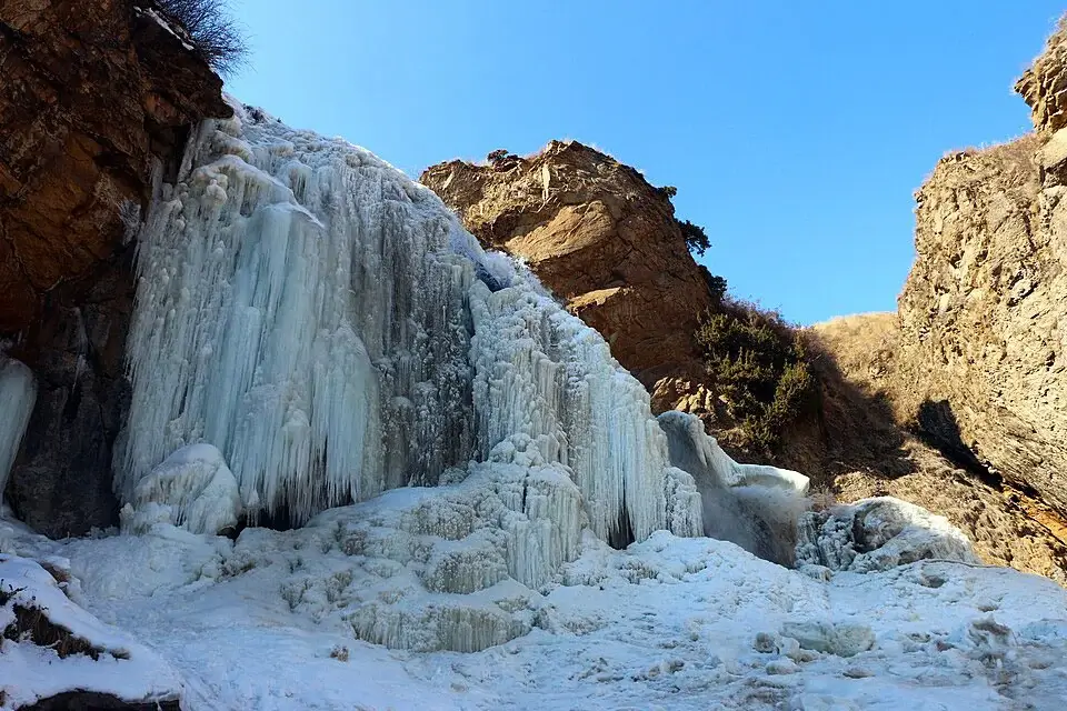
- November to March — variable. Heavy snow makes the access road from Sarapat unreliable, and partial freezing can produce dramatic ice formations on the cliff. Not recommended for casual visitors.
The waterfall sits at about 1,500 m elevation, so temperatures are noticeably cooler than in Yerevan even in July.
How to Get to Trchkan Waterfall from Yerevan
Trchkan is about 180 km north of Yerevan, roughly a 2.5–3 hour drive along the M1 (Yerevan–Gyumri) highway followed by a smaller road through Sarapat village in Shirak Province.
By private car with driver. The most practical option, especially because the final stretch from the highway to Trchkan is unpaved and rough — most drivers strongly recommend a vehicle with high clearance or 4×4 capability for the last few kilometres. We provide private cars and drivers in Yerevan for northern day trips.
By car from Gyumri. Trchkan is about an hour from Gyumri, Armenia’s second-largest city. If you’re already spending time in Gyumri, a Trchkan day trip is straightforward — local drivers in Gyumri know the route well.
On foot from Sarapat. From the village of Sarapat in Shirak Province, a marked hiking trail follows the Chichkhan River for around 4–5 km to the top of the waterfall. Allow about 1.5 hours each way at an easy pace. This is the Trout Jump Trail, one of Armenia’s best-known short hikes.
The road conditions deserve a separate warning: the final approach is unpaved, occasionally muddy after rain, and not suitable for low-clearance cars. Some Yerevan taxi drivers will refuse the last section.
Combining with Gyumri and Northern Armenia
Trchkan is rarely visited on its own — it’s almost always combined with at least one other northern stop:
- Gyumri (about 60 km west) — Armenia’s second-largest city, with a beautifully preserved 19th-century old town in pale tuff stone, Kumayri Historic District, and several excellent museums. A natural overnight base for visiting Trchkan.
- Chichkhanavank — a small 7th-century chapel near the waterfall, destroyed in the 1988 Spitak earthquake and rebuilt between 2013 and 2015. A short walk from Trchkan.
- Shirakamut (about 10 km from the falls) — the village that was the epicentre of the 1988 Spitak earthquake, with quiet memorial sites.
- Lori-Berd Fortress (about 80 km east) — a medieval Armenian fortress on a triangular plateau between two river canyons.
- Haghpat and Sanahin Monasteries (about 100 km east, both UNESCO World Heritage) — twin medieval monasteries in the Debed Canyon.
A typical 2-day northern Armenia itinerary: day 1 — Yerevan to Gyumri (Kumayri district and old town), overnight in Gyumri; day 2 — Trchkan Waterfall and Chichkhanavank in the morning, then drive east to Lori-Berd or onward to Haghpat/Sanahin.
Practical Tips for Visiting
- Opening hours: the waterfall is outdoors and accessible all day. No gate.
- Entrance fee: free.
- Time needed: plan around 2 hours at the falls themselves, plus driving and hiking time. From Sarapat allow 4–5 hours total round trip with the hike.
- Footwear: the path to the falls is uneven, sometimes muddy, and the ledge into the cave behind the water is wet and slippery. Sturdy walking shoes are essential.
- Vehicle: the final approach road is unpaved. A 4×4 or high-clearance car is strongly recommended; some sedans cannot make it.
- Layers: Trchkan sits at around 1,500 m and the gorge stays cool. Bring a light jacket even in summer.
- Mobile signal: weak or absent in the gorge. Download offline maps before leaving Sarapat.
- Picnic areas: there are simple picnic benches and barbecue spots around the falls. There are no shops or kiosks — bring everything with you.
- Wildlife: the area is home to several bird and plant species listed in Armenia’s Red Book. Tread lightly.
FAQ
See more places in our full guide to things to do in Armenia — including Jermuk Waterfall, Shaki Waterfall, Tatev Monastery, Lake Sevan and other top destinations.


